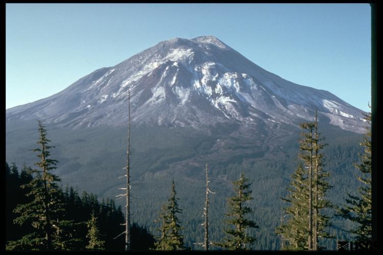
In early 1980, a bulge appeared on the north side of Mount St. Helens, a volcano in the state of Washington (Figure 1). By late March, the bulge was growing almost 2 meters per day. By May 17, the bulge had grown by over 130 meters (See also the USGS summary).
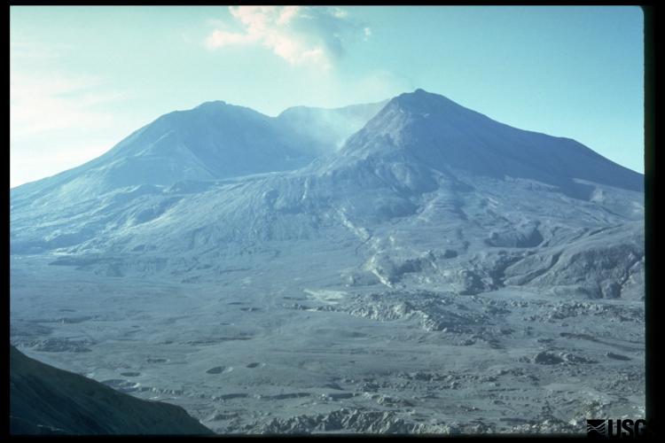
Volcanologists studying Mount St. Helens recognized that the volcano was building to an eruption. What they didn't anticipate was how the eruption would occur. They expected the explosions to be directed upward, toward the sky. Instead, on May 18, 1980, at 8:32 a.m., an earthquake trigged a landslide that in turn triggered an eruption—directed sideways out of the volcano (Figure 2).
Scientists now recognize that these lateral blasts are common, and have occurred at volcanoes around the world. By understanding volcano deformation, or movement of the surface of a volcano in response to what's going on in its plumbing system down below, we can better anticipate both how and when a volcano is likely to erupt.


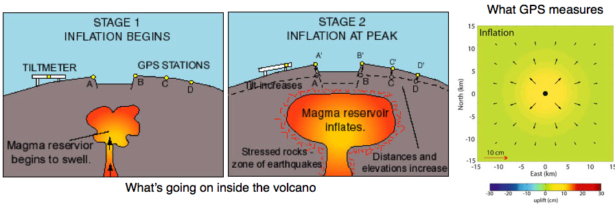
Changes in the magma system feeding a volcano can actually change the shape of a volcano. When magma moves into the system, pressurizing it, the ground above the magma moves upward and outward, "inflating" like a balloon. When magma or fluids move out of the system, the volcano contracts, or "deflates." (See Figure 3). Sometimes, these motions tell us what the magma is doing deep below a volcano. Sometimes, as in the case at Mount St. Helens, these motions can tell us what the magma is doing up high in the volcano, and what to expect when it reaches the surface.
GPS can precisely measure both horizontal and vertical motions. GPS and other instruments used to measure deformation may detect motion at a volcano before any earthquakes occur, and these changes in shape may accelerate immediately before an eruption, making GPS a valuable monitoring tool. GPS also helps us understand how magmatic systems work so that we may better plan for eruptions. Combining GPS with seismicity, gas emissions, and changes in water chemistry around the volcano paints an even better picture of what is going on below the surface.

Last modified: 2019-12-26 16:24:59 America/Denver


Please send comments and corrections to education unavco.org.
Copyright © 2012 - 2026 UNAVCO and the GPS Reflections Research Group.
All Rights Reserved.