When you say you know your location, what does that mean? Latitude and longitude are fairly well known concepts—but how did they decide that zero latitude went through the Greenwich Meridian? When they defined the Cartesian system, why did the Z-axis go through the north pole instead of the south pole? These are conventions used by geodesy, the science of measuring position.
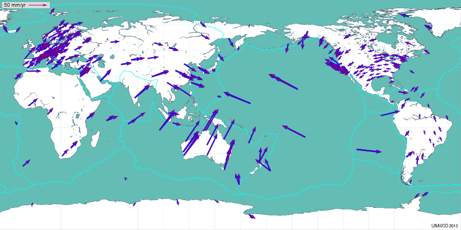
In order to interpret GPS coordinates (and how they change), geodesists have also adapted conventions that allow us to define and interpret our results. The convention we use is called the International Terrestrial Reference Frame. The ITRF carefully analyzes data from GPS networks as well as from other geodetic measurement systems: VLBI (Very-long-baseline Interferometry), SLR (Satellite Laser Ranging), and DORIS (Doppler Orbitography and Radio-positioning Integrated by Satellite). From these data, ITRF defines the motions of sites all around the world. A scientist who analyzes GPS data using the ITRF can be sure that the results can be compared with the analyses of other scientists without bias. Often ITRF is followed by a number, such as ITRF2008. This simply tells you which ITRF model was used by that data analyst. Geodesists continually try to improve their coordinate frame definition, so this means that every few years a new one is released. Most geodesists (and geophysicists) then reanalyze their data using the new frame.

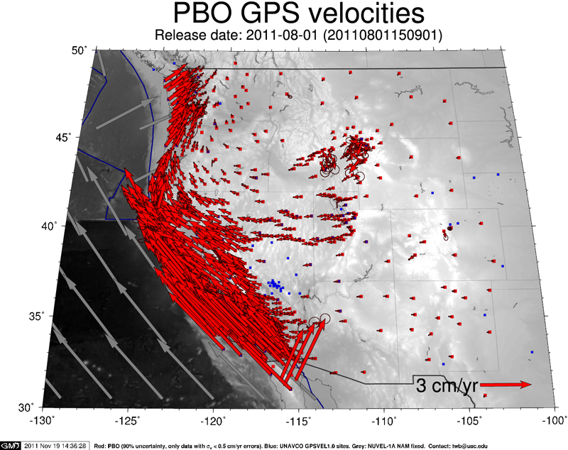
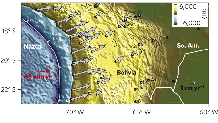
The ITRF is very useful for scientists to compare results, but it is not intuitive at all. To look at GPS results to understand geophysics, it is better to use what is called a "fixed" reference frame. On this website most of the results are shown in the North American fixed reference frame. These values are straightforward to compute: we calculate what ITRF expects this site to do on the North American tectonic plate. Then we subtract this "plate-fixed" velocity from our observed velocity. If the site is moving perfectly with a tectonic plate, its velocity in that frame is zero.
Shown in Figures 3 and 4 are geophysical results from two different perspectives. Figure 3 shows results for almost 1000 stations in a North American fixed reference frame. If you can't see a vector, that station is moving at the same velocity as North America. As you get closer to the Pacific Ocean, the vectors get bigger. This is because you are getting closer and closer to the Pacific plate motion. Figure 4 shows geophysical results in a South America fixed reference frame. The sites in Chile are moving towards South America. This is because Chile is in the Nazca-South America plate boundary. It is not on either rigid plate.


Last modified: 2019-12-26 16:24:58 America/Denver


Please send comments and corrections to education unavco.org.
Copyright © 2012 - 2026 UNAVCO and the GPS Reflections Research Group.
All Rights Reserved.