The basic principles described on the Decoding the Signal page explained how GPS works. Even though various parts of the GPS system (orbits, clocks, atmospheric delays) are only known with an accuracy of 1-2 meters, this is more than good enough for most users. And this is how the designers of GPS expected it to be used for navigation: it can tell you your location on a map immediately. If you are hiking or riding in a car, you only need for your GPS unit to keep you going in the right direction.
Geocientists and surveyors, however, are trying to do something a little different. Geoscientists, in particular, are trying to find out how the Earth is changing. Changing? It may not look like it is changing right now, but our landscape has evolved over thousands and millions of years. How big a signal are we talking about? Well, the San Andreas Fault moves approximately 35 mm in one year. So having a GPS receiver that would tell you where you are with an accuracy of a few meters would not be very helpful if you wanted to study faults. It's the very small size of Earth deformation signals that has pushed geoscientists to come up with new ideas on how to use GPS to measure these challenging signals.
How do they do it?
The trick geoscientists and surveyors use is to take advantage of how a radio signal is transmitted. First, ask yourself how the GPS code is sent from the satellite. While it is easy to think about codes (1s and 0s), it isn't obvious how you would transmit that information. For radio, we use what is called a carrier signal (Figures 1 and 2). Once the receiver has figured out how to synchronize the codes for each satellite, the codes can be removed. Then scientists can use the carrier wave itself. Since the carrier wavelength (20 cm) is much shorter than the code wavelength (30 or 300 m, depending on which code is used), scientists can achieve correspondingly more precise positions. This is the big difference between a hand-held GPS receiver and the one that geoscientists use.
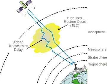
Geoscientists also use more precise methods to remove the effects of the atmosphere than a handheld GPS receiver uses. The ionosphere, a region approximately 600 km above the Earth with large concentrations of charged electrons, changes the GPS signal. The ionosphere alone can cause errors of ~50 meters. Fortunately the GPS designers used two frequencies (they are called L1 and L2, and are defined to be 1.5754 GHz and 1.2276 GHz) and these can be combined to remove the effect of the ionosphere.
The lower atmosphere (also known as the troposphere) is a bigger problem for scientists. If nothing is done, it causes errors of ~2 meters. This is not a problem for navigating a car, but it cannot be ignored if you want to find your position to a precision of 5 mm. Fortunately scientists have successfully developed models to do a very good job of removing atmospheric errors.
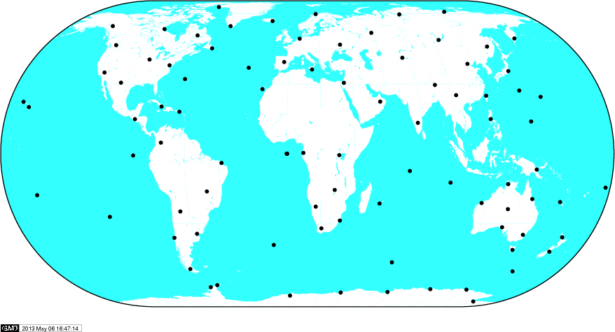
Another thing scientists have done to improve GPS is to operate their own satellite-tracking network. Remember we showed you the tracking network run by the Control Segment? It was actually pretty small—and that was perfectly fine for its purpose: real-time orbit determination for the GPS constellation. A long time ago scientists realized that if they worked together, they could operate a much larger and much better tracking network. Today there is almost no part of the world that doesn't run a GPS tracking site. Every country donates their data to a central data processing organization, called the International GNSS Service (IGS). By using carrier data and advanced models for satellites dynamics, the IGS offers the most accurate GPS orbit products in the world. They are all freely available and include real-time orbits for anyone who needs them.


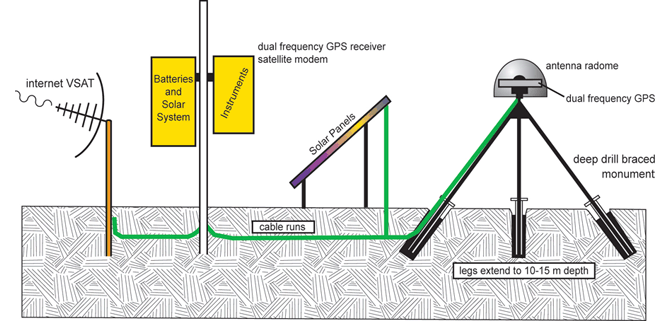
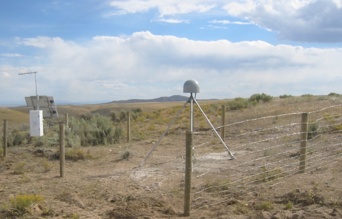
In summary, GPS geoscientists use very precise (carrier) data, orbits, sophisticated troposphere models, and GPS receivers that can use two frequencies. The GPS antennas are designed to reduce the error source associated with reflected signals. (This error is also called multipath.) One final step that scientists emphasize is "anchoring" the antennas to bedrock if at all possible. Since they want to measure how the Earth's crust is moving, it makes sense that they would want to tie their instrument to the rock. Drilling engineers are needed to make these state-of-the-art GPS monuments.


Last modified: 2019-12-26 16:24:58 America/Denver


Please send comments and corrections to education unavco.org.
Copyright © 2012 - 2026 UNAVCO and the GPS Reflections Research Group.
All Rights Reserved.