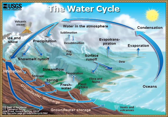
Scientists quickly recognized the value of GPS for measuring how Earth deforms. GPS instruments have been deployed to measure plate motions, volcanoes, and earthquakes since the mid-1980s. Only recently have scientists realized the potential of the GPS technique for studying Earth's water cycle (Figure 1). The earliest results showed that measuring how the GPS signal is slowed by the atmosphere could be used to estimate how much water is in the atmosphere (there is a very nice youtube video at this link.) Other scientists have taken advantage of the fact that large loads of water (ice sheets, ground water, lakes) make Earth deform.
Most recently, the PBO H2O group has used reflected GPS signals to estimate soil moisture, snow depth, vegetation growth, and sea level. This technique fills a gap in the current knowledge about the water cycle by providing data for areas approximately 1000 square meters, a scale intermediate between the very large footprints provided by satellite imaging and the point measurement using manual methods. Another advantage is that the data are available continuously regardless of cloud cover or availability of labor.
For more information on the water cycle in general, please check out this website at UCSD. or take the USGS Ground Water quiz.
Last modified: 2019-12-26 16:24:59 America/Denver

Please send comments and corrections to education unavco.org.
Copyright © 2012 - 2026 UNAVCO and the GPS Reflections Research Group.
All Rights Reserved.

 Spotlight Map
 GNSS Videos
 Funding and Acknowledgements