Much of geophysics is learning about things that we cannot see. We cannot see the layers of Earth, but we know they are there because of the way seismic waves travel through the planet. Similarly, we cannot see the fault underneath the ground, but we can infer that it is there through our observations at the surface of Earth. One way to understand what is going on inside the Earth is to make models. These models are based on physics and mathematics. The goal is to find a model that best fits the observations.
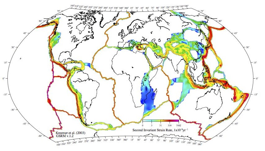
Some examples of geophysical models are given in Figures 1-3. In Figure 1, seismic hazard maps are shown. These maps rely on knowledge of fault motion determined from GPS measurements of crustal deformation. Figure 2 shows a global model that uses GPS data to determine deformation zones. Figure 3 shows model for the Tokachi-Oki earthquake, both in terms of the deformation from the earthquake and one month of afterslip.


Last modified: 2019-12-26 16:24:59 America/Denver


Please send comments and corrections to education unavco.org.
Copyright © 2012 - 2026 UNAVCO and the GPS Reflections Research Group.
All Rights Reserved.