Science Spotlight

Station P405


Researcher: Ken Austin
UNAVCO

Smoking from Mt St Helens Volcano can be seen behind Ken in this photo.


P405 was installed near the crest of the Oregon Coast Range.


Name: TRI POINT
State: OR
Country: United States
Elevation: 955.7 m
Lat/Long:  45.6293 / -123.6438

Cascadia Subduction

Like sites NEAH (Washington) and ALBH (British Columbia), P405 sits on the edge of the Cascadia margin—where the North American plate meets the subducting Juan de Fuca plate. The interface between the two plates is capable of generating some of the largest earthquakes in the world. The last major earthquake was in 1700, as deduced by geologic clues such as submerged forests along the coasts of Oregon and Washington, and tsunami records across the Pacific Ocean in Japan. P405 is recording close to the maximum deformation caused by the converging plates.

Located near the crest of the Oregon Coast Ranges, P405 is subjected to severe weather, and has had the solar system that powers it destroyed twice by winds in excess of 120mph. The station is part of the Cascadia real time network, meaning that it sends data constantly rather than just once a day, like most sites do. It is slated to have a backup satellite communications system installed to keep data flowing in the event of a large Cascadia earthquake.

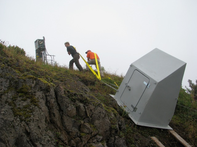
Figure 1. UNAVCO engineers Korey Dausz and Mike Gottlieb haul an enclosure to house the electronics for P405.


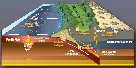
Figure 3. The Cascadia subduction zone showing the Coastal Range and the Cascade volcanoes. P405 is located near the crest of the Coastal Range. (Credit: Robert J. Lillie via The Oregon Historical Society.)


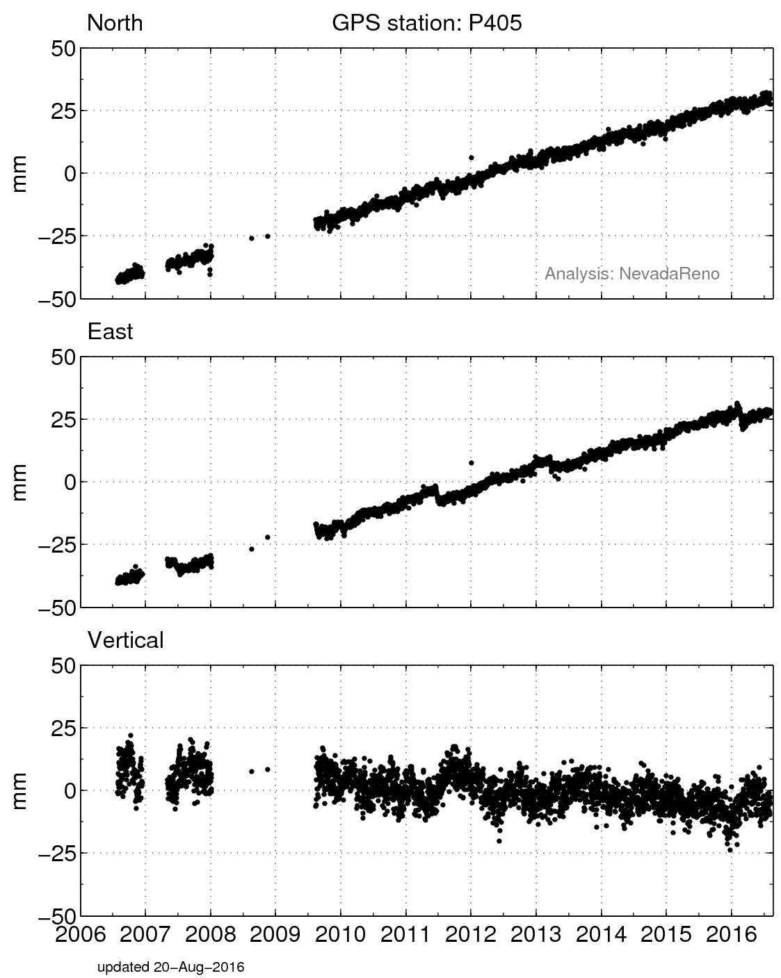
Figure 5. Position changes for P405 in a North America fixed reference frame. (For help interpreting the graphs, see the GPS Data page.)


Figure 2. P405, complete.


Figure 4. Velocity vectors for GPS sites in the Pacific Northwest, highlighting the motions of P405, ALBH, and P393.

Spotlight Questions

  • What direction is P405 moving? What are some reasons it may be moving in this direction?
  • How does the motion of P405 compare to the motion of P393? Why is it helpful to compare the motion of these two sites? What might this tell you about why there are mountains in western Oregon, and whether they are still forming?
  • Is P405's motion consistent over time? What might cause the variations in the horizontal components? (Hint: See ALBH.)
  • Classroom exercise: Detecting Cascadia’s changing shape with GPS Data

Last modified: 2019-12-26  16:24:52  America/Denver  


Please send comments and corrections to educationunavco.org.

Copyright © 2012 - 2025 UNAVCO and the GPS Reflections Research Group.
All Rights Reserved.

Funding and Acknowledgements.