Science Spotlight

Station GLS1


Researcher: Kent Anderson
IRIS


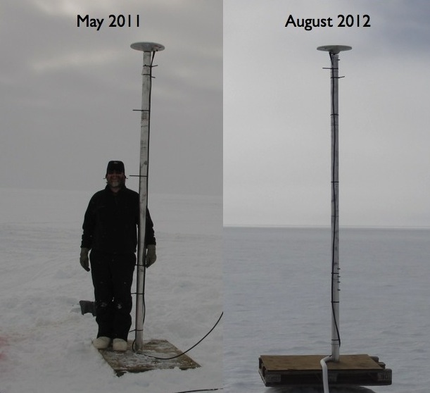
The antenna for GLS1 is on top of a ~5 meter pole. Three meters of the pole are above the snow. The photo on the right shows that the snow levels were much lower in 2012 than 2011.


Name: GLISN 1
Country: Greenland
Elevation: 2150.0 m
Lat/Long:  66.4794 / -46.3102

Greenland Ice Sheet Monitoring Network

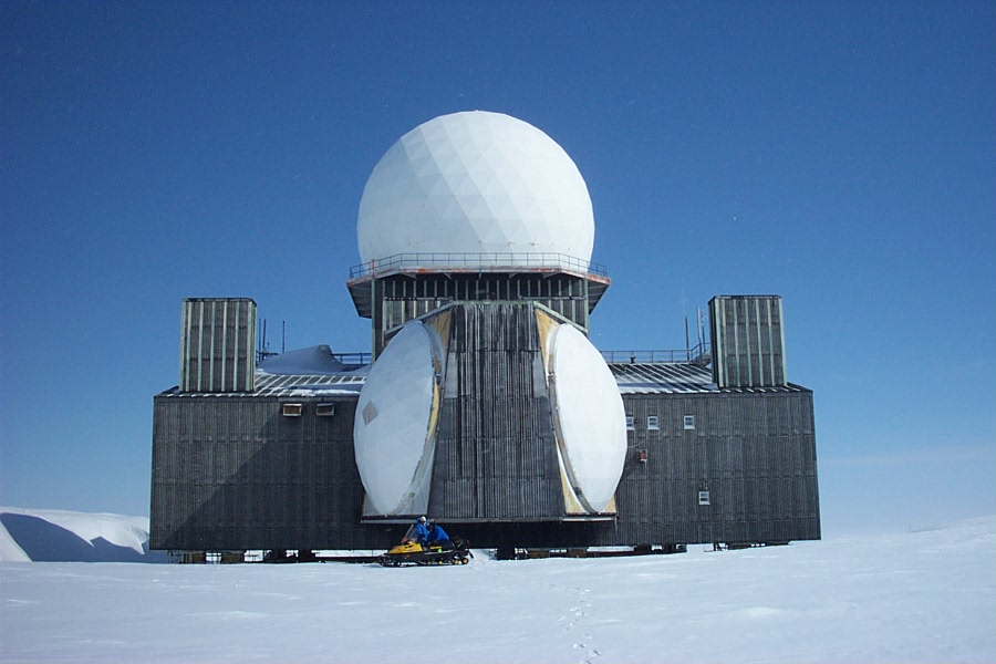
The GLISN (Greenland Ice Sheet Monitoring Network) project has installed seismic sensors to detect, locate, and characterize glacial earthquakes and other cryo-seismic phenomena. GLISN also contributes to our understanding of ice sheet dynamics by operating three GPS sites: GLS1, GLS2, and GLS3. These sites are the subject of this spotlight. GLS1 is located at Raven Camp, near the DYE-2 auxiliary radar station.

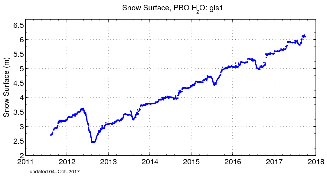
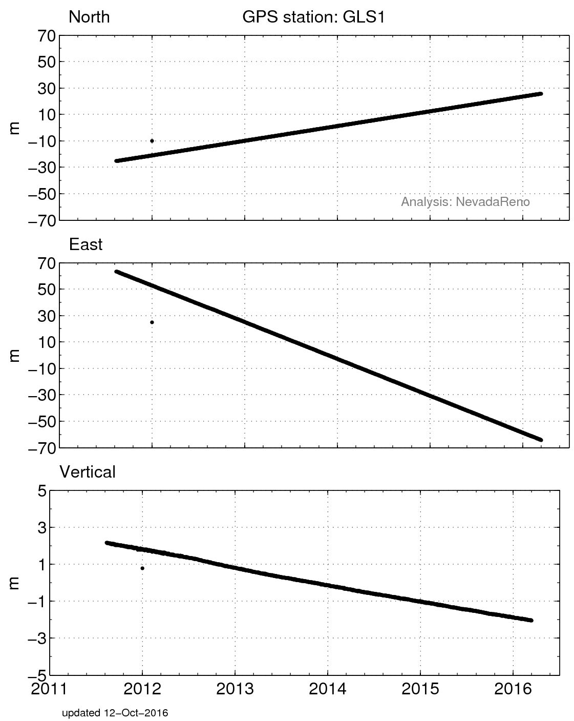
GPS instruments are traditionally used to calculate position. So for GLS1, the GPS data tell you how fast the ice sheet is moving. The University of Nevada, Reno Geodetic Lab analyzes positions for the GLS1 site (plotted in Figure 4). The data show that the site is moving 10s of meters per year to the northwest and downward at a rate of almost one meter per year. Reflected GPS signals tell you the vertical distance between the ice/snow surface and the antenna (see Figure 3). From this you can calculate snow accumulation rates (see Figure 1).

Figure 1. Snow accumulation at GLS1 measured using reflected GPS signals. The GPS data are telemetered back to UNAVCO every day, and processed by the PBO H2O group at the University of Colorado the next morning.


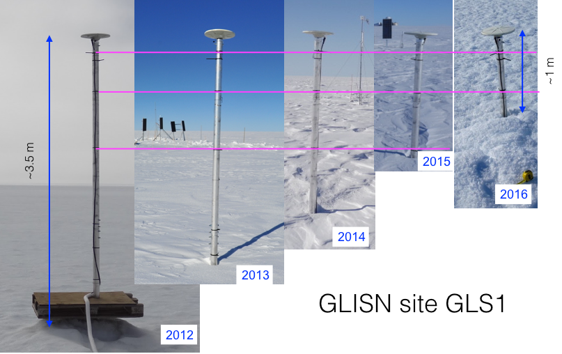
Figure 3.Photos of the GLS1 antenna taken each summer from 2012-2016. These photographs are consistent with the snow accumulation values shown in Figure 2.


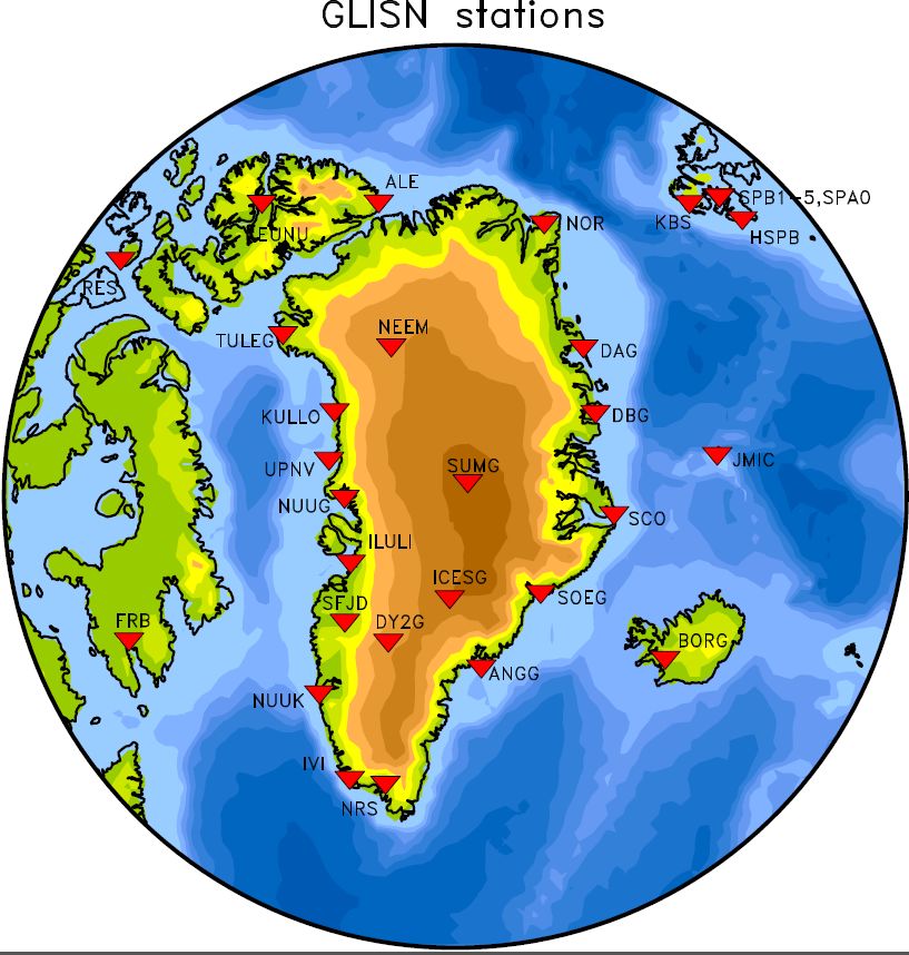
Figure 5. Map of GLISN sites. DY2G is the GLS1 GPS site. GLISN is supported by the National Science Foundation.


Figure 2. GLS1 is located near the DYE-2 auxiliary radar station in Greenland.


Figure 4. Position changes for GLS1 in a North America fixed reference frame. (For help interpreting the graphs, see the GPS Data page.) Note that unlike the sites on bedrock, these positions changes are displayed in meters.


Last modified: 2019-12-26  16:24:56  America/Denver  


Please send comments and corrections to educationunavco.org.

Copyright © 2012 - 2025 UNAVCO and the GPS Reflections Research Group.
All Rights Reserved.

Funding and Acknowledgements.