Science Spotlight

Station CRBT


Researcher: Kevin Choi
National Geodetic Survey


CRBT is just north of Paso Robles.


Name: CRBT SCGN
State: CA
Country: United States
Elevation: 205.4 m
Lat/Long:  35.7916 / -120.7508

San Simeon Earthquake

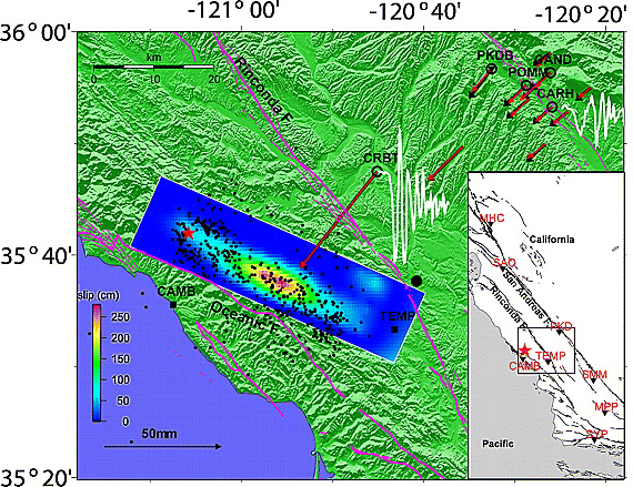
While many geophysicists were waiting for the predicted Parkfield earthquake, a much larger earthquake occurred near San Simeon, California, on December 22, 2003. This Mw 6.5 earthquake occurred on the Oceanic fault, 50 km from the San Andreas Fault. In anticipation of the Parkfield event, scientists from the USGS and UCSD had installed a network of GPS receivers along the San Andreas Fault. These sites were set to collect data every second. This is much more frequent than is typically used to measure the slow motions associated with plate tectonics. Because of their sampling rates, it was possible to use the data from these GPS receivers to measure seismic waves. Before the GPS seismology technique was developed, inertial seismic sensors were used to measure the ground motion during an earthquake. It was thought that GPS could only measure the "before" and "after" position of the fault. The San Simeon earthquake GPS dataset was the first to show that GPS data could be used like traditional seismic data to invert for fault slip [Ji et al., GRL, 2004].

Figure 1. The red star shows the epicenter in the inset location map along with strong motion stations used and nearby major faults. Surface projection of the derived slip distribution is shown in the main figure, against the aftershock distribution (black dots), with the color bar indicating the slip amplitude. Observed GPS horizontal static offsets (black arrows) are compared with synthetics (red arrows). Open circles indicate those stations where 1-Hz GPS data were used to constrain this slip model. Credit: Ji et al. 2004.


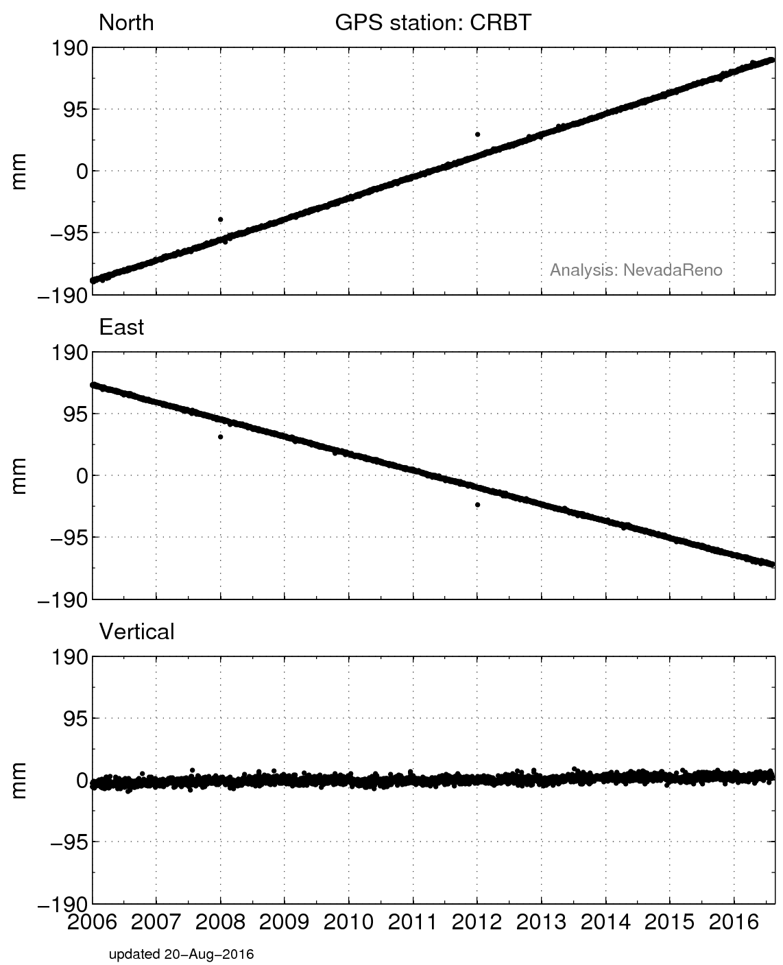
Figure 3. Position changes for CRBT in a North American fixed reference frame. (For help interpreting the graphs, see the GPS Data page.) Credit: Kristine Larson.


Figure 2. GPS position estimates measured once per second for the San Simeon earthquake. Credit: Kristine Larson.


Figure 4. Position changes for CRBT in a North American reference frame for the time period immediately before and after the earthquake in December 2003. Credit: Kristine Larson.

Spotlight Questions

  • Can you tell from the data whether the San Simeon Earthquake was a strike-slip, thrust, or normal earthquake? What does the USGS National Earthquake Information website say?

Last modified: 2019-12-26  16:24:57  America/Denver  


Please send comments and corrections to educationunavco.org.

Copyright © 2012 - 2025 UNAVCO and the GPS Reflections Research Group.
All Rights Reserved.

Funding and Acknowledgements.