We live in a semi-arid environment where water is limited and the population is growing rapidly. Most of our water comes from wintertime precipitation, which at higher elevations is in the form of snow that accumulates to considerable depths. By the end of winter,
snow water equivalent—the amount of water produced if you could melt the snowpack instantaneously—can reach 1.5m in many intermountain west
montane areas. This snowpack is the water reservoir that provides growing season water for agriculture as well as water for human consumption. Two critical factors that affect water availability are snow accumulation, and snowmelt dynamics. These processes are affected by among other things vegetation type and soil properties. Our research at
T.W. Daniels Experimental Forest (TWDEF) is designed to better understand how native vegetation and soil properties affect snowmelt infiltration and soil water storage.
RN86 was installed to validate the
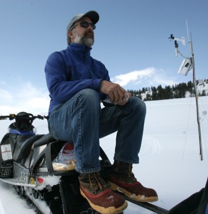
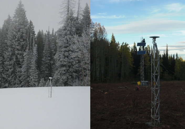
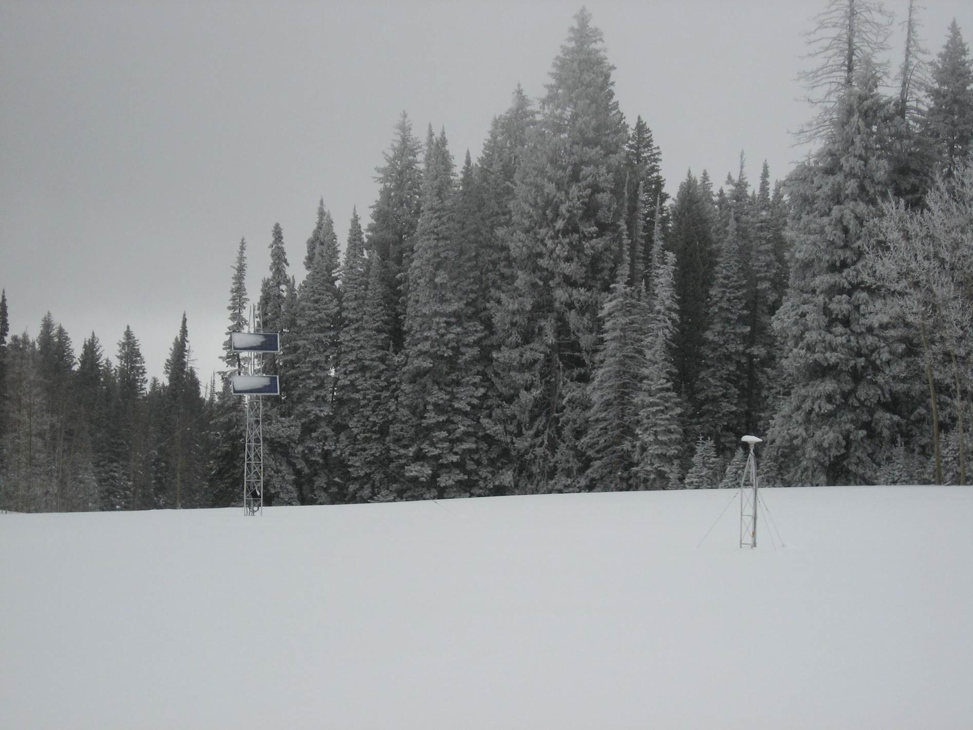
GPS technique for measuring snow depth. While initial snow results from 2 other sites were very successful, neither site had any trees. This site was deliberately chosen because it is surrounded by trees. This makes it difficult for the GPS receiver to track the reflected signal. Because snow levels regularly reach 2 meters in this region, this particular GPS antenna was built to be 3 meters above the ground. You can see the solar panels that power the GPS system in the background.
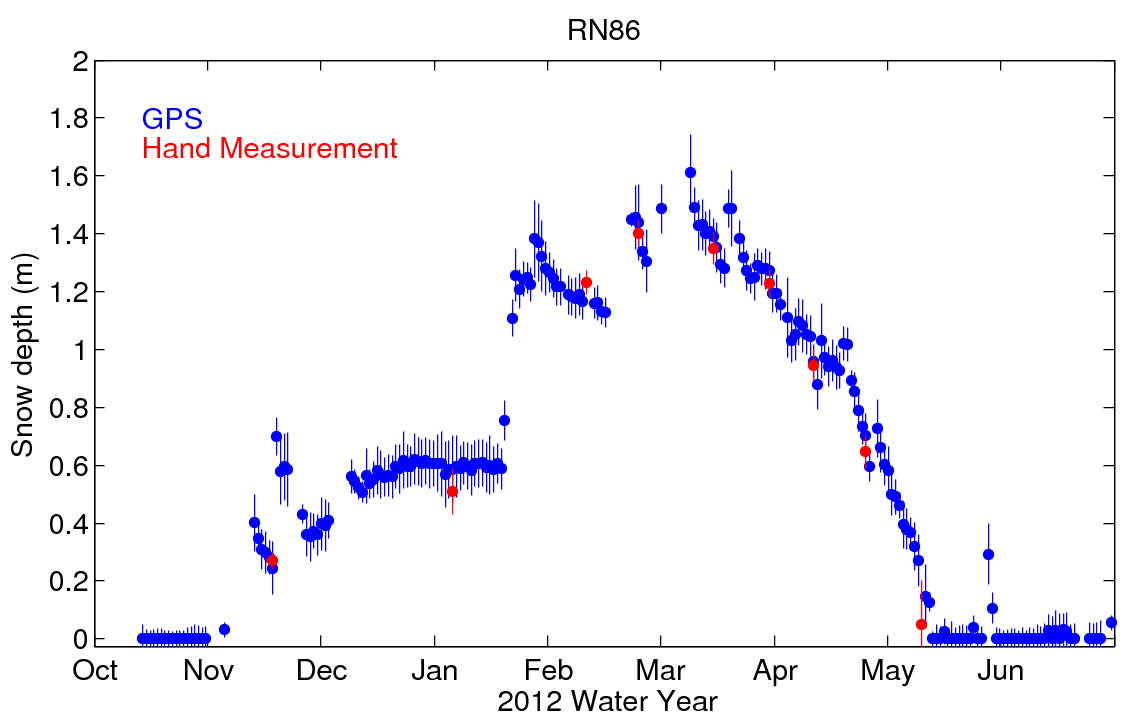
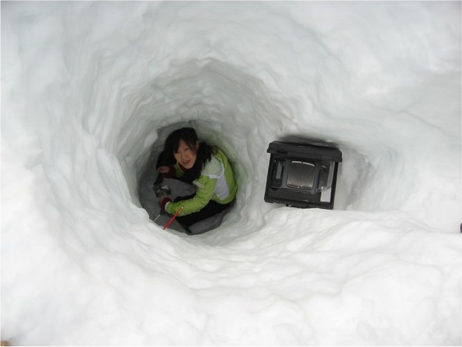
It can be difficult to validate any new measurement system. At this site we have used multiple ways to do it. The best way to validate the system is to make manual measurements of snow depth in the same footprint as the GPS. This is what is shown in Figure 1. A second way to validate the system is to compare it with a nearby sensor operated by the
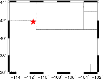
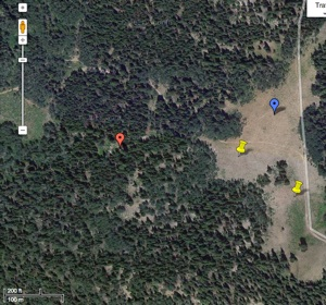
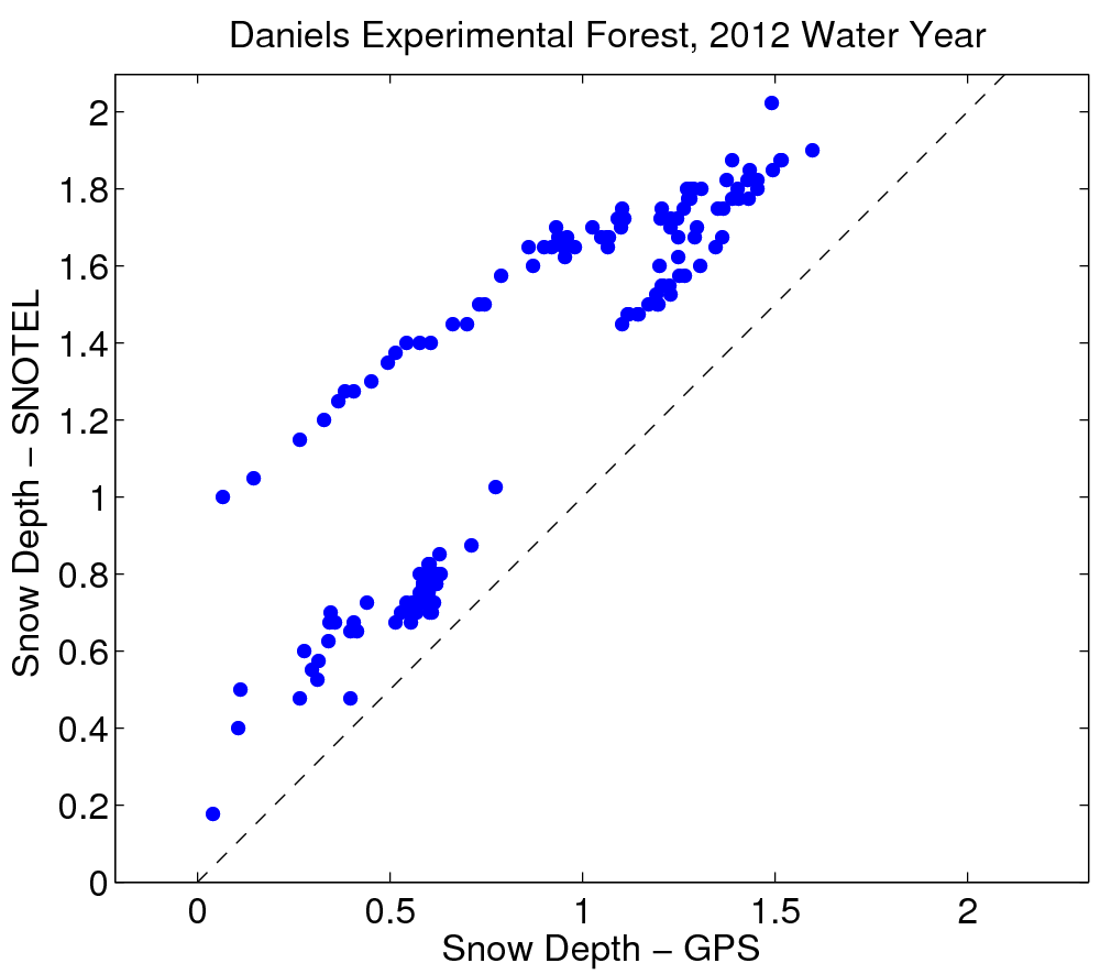
SNOTEL network (locations are shown in Figure 3). Since snowfall is spatially variable, differences are to be expected. A correlation plot (Figure 4) shows that the SNOTEL site always has more snow than the GPS site. This highlights one of the challenges of snow monitoring. There can be significant differences in snow cover for sites that are fairly close together depending on whether they are on northern slopes or in protected areas. If we are to accurately predict how much water we can expect to extract from snow in the mountains, it is important to quantify and understand these differences.
Snowmelt movie
(mp4 format)
This site was installed by UNAVCO with funding provided by NSF EAR 0948957.

 unavco.org.

 Spotlight Map
 GNSS Videos
 Funding and Acknowledgements