Science Spotlight

Station RLAP


Researcher: John Paul Puchakayala
University of Memphis

Being from a country surrounded by plate boundaries that cause destructive earthquakes in highly populated areas, I always wanted to obtain skills to study and research the processes that caused them.


The RLAP GPS site is located in northwestern Tennessee, on the northern end of Reelfoot Lake.


Name: ReelfootAirport
State: TN
Country: United States
Elevation: 57.9 m
Lat/Long:  36.474 / -89.345

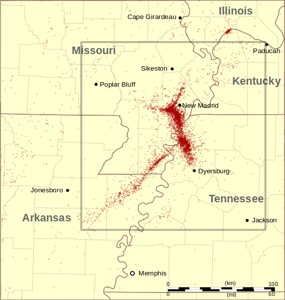
New Madrid Seismic Zone

In the winter of 1811–1812, near the town of New Madrid in the central United States and more than 2,000 km from the nearest plate boundary, three earthquakes within three months shook the entire eastern half of the country. The large magnitudes of these quakes are not just inferred from word-of-mouth and print accounts, but also from a variety of geological signatures the quakes left behind. For example: Before 1811, the area of Reelfoot Lake was a dense forest, penetrated only by Native American trails and coarsely constructed roads. During the 1811 earthquake this section of landscape subsided, and this shifting of the Earth caused the Mississippi River to actually flow backwards for a period of about 10 to 24 hours, filling the sunken area and forming Reelfoot Lake.

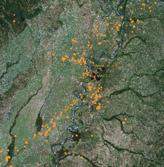
RLAP is one of several GPS sites near Reelfoot Lake. Using the relative movements across this network of GPS sites, we can infer the tectonic activity across the New Madrid fault system. The GPS stations will measure either the postseismic deformation (stresses still releasing after an earthquake) or interseismic deformation (building-up stresses between earthquakes) of the region. We also collect 1 Hz data (data at a 1 second interval) from all these sites, which are very useful in studying earthquakes that occur in the region as well as far away.

Figure 1. Red dots indicate earthquakes recorded in the New Madrid Seismic Zone from 1974 to 2011. Most of these earthquakes are too small to be felt. The area shown in Figure 2 is indicated by the gray box. (Credit: Center for Earthquake Research and Information at University of Memphis via Wikimedia Commons)


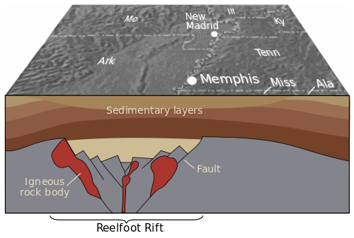
Figure 3. The Reelfoot Rift, here shown in cross section, formed more than 500 million years ago when powerful geologic forces began to pull the Earth's crust apart. These structures were deeply buried over hundreds of millions of years by thick layers of sediment, later to be discovered through geophysical studies. Most quakes in the central Mississippi Valley appear to be related to the major faults and large bodies of igneous rock within this rift. (Credit: USGS, image via Wikimedia Commons)


Figure 2. Four GPS sites (red circles) are situated near the Reelfoot Fault. This fault was active during the 1811 earthquakes. These GPS sites help in monitoring the deformation magnitudes and styles at this important fault. The orange dots show the locations of earthquakes that occurred between 1973 and 2013.


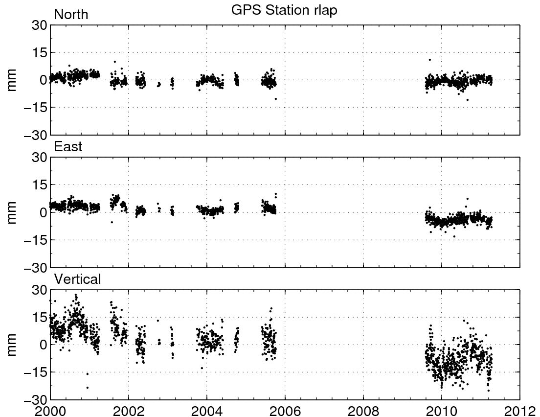
Figure 4. Position changes for RLAP in a North America fixed reference frame. (For help interpreting the graphs, see the GPS Data page.)

Spotlight Questions

  • What is the motion, roughly, of RLAP, relative to stable North America?
  • Is it important to measure positions of GPS sites in the New Madrid area, even if the sites appear not to be moving? Why or why not?

Last modified: 2019-12-26  16:24:50  America/Denver  


Please send comments and corrections to educationunavco.org.

Copyright © 2012 - 2024 UNAVCO and the GPS Reflections Research Group.
All Rights Reserved.

Funding and Acknowledgements.