Science Spotlight

Station NWOT


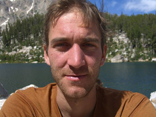
Researcher: Ethan Gutmann
National Center for Atmospheric Research

I love working as a scientist at NCAR because I get to learn new things every day, I get to do field work in amazing parts of the world, and I feel that my work is helpful to society.


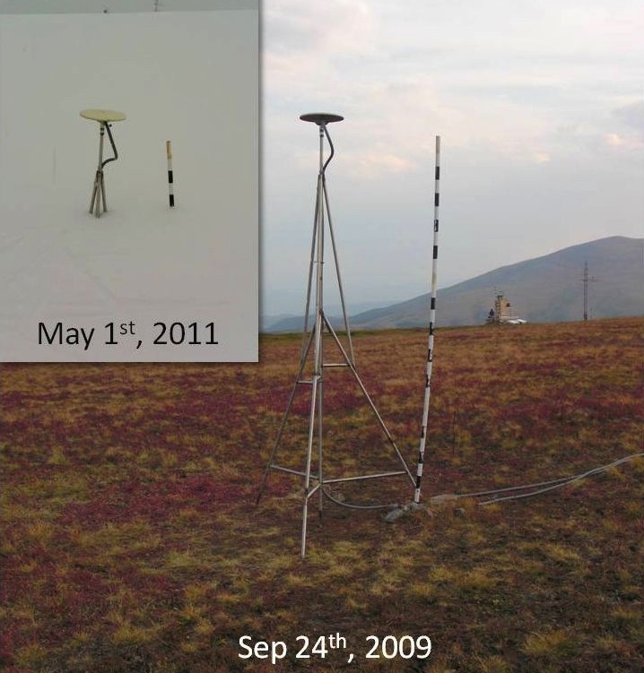
The NWOT GPS antenna (flat disk) has been mounted on a 3-meter tripod, to ensure it is always above the snow. You can see that in May 2011, the site was almost buried. The pole shown on the right is read manually about every two weeks to record snow depth.


Name: BOULDER
State: CO
Country: United States
Elevation: 3522.5 m
Lat/Long:  40.0554 / -105.5905

Snow Measurements at Niwot Ridge

Snow supplies drinking water for millions of people in the United States, and many more worldwide. Because of that, measurements of snow are of great importance to society. However, such measurements are often difficult to make, particularly in mountain environments in the winter, where we need them the most. Because winter temperatures rarely rise above freezing, snow in the mountains gets deeper and deeper over the course of a winter. At the end of the season, mountain snowpack can vary from non-existent to over 12 meters deep depending on where you measure it. This variation is primarily caused by wind blowing the snow from one location to another in deep drifts. The Niwot Ridge Long Term Ecological Research Station was created in part to understand this important water resource.

We are using the GPS instrument at Niwot Ridge to measure snow depth in an extremely harsh environment, as it is very windy and cold on Niwot Ridge. The GPS instrument has worked very well throughout the snow seasons. We can use the GPS to measure snow depth by looking at the noise recorded by the GPS receiver. When a GPS satellite rises from the horizon, the signal reflects off the snow surface and changes the noise recorded by the instrument. The patterns this creates in the noise allow us to determine how deep the snow is. We have used the GPS to measure snow depths of about 1 meter in one year, and more than 3 meters in the following year. This sort of variability is important for water managers to know about. During these same years, a measurement made at lower elevations in the trees only changed from about 1 meter to 1.5 meters.

This site was installed by UNAVCO with funding provided by NSF EAR 0948957, the Dean of Engineering at the University of Colorado, and a receiver provided by Trimble Navigation.

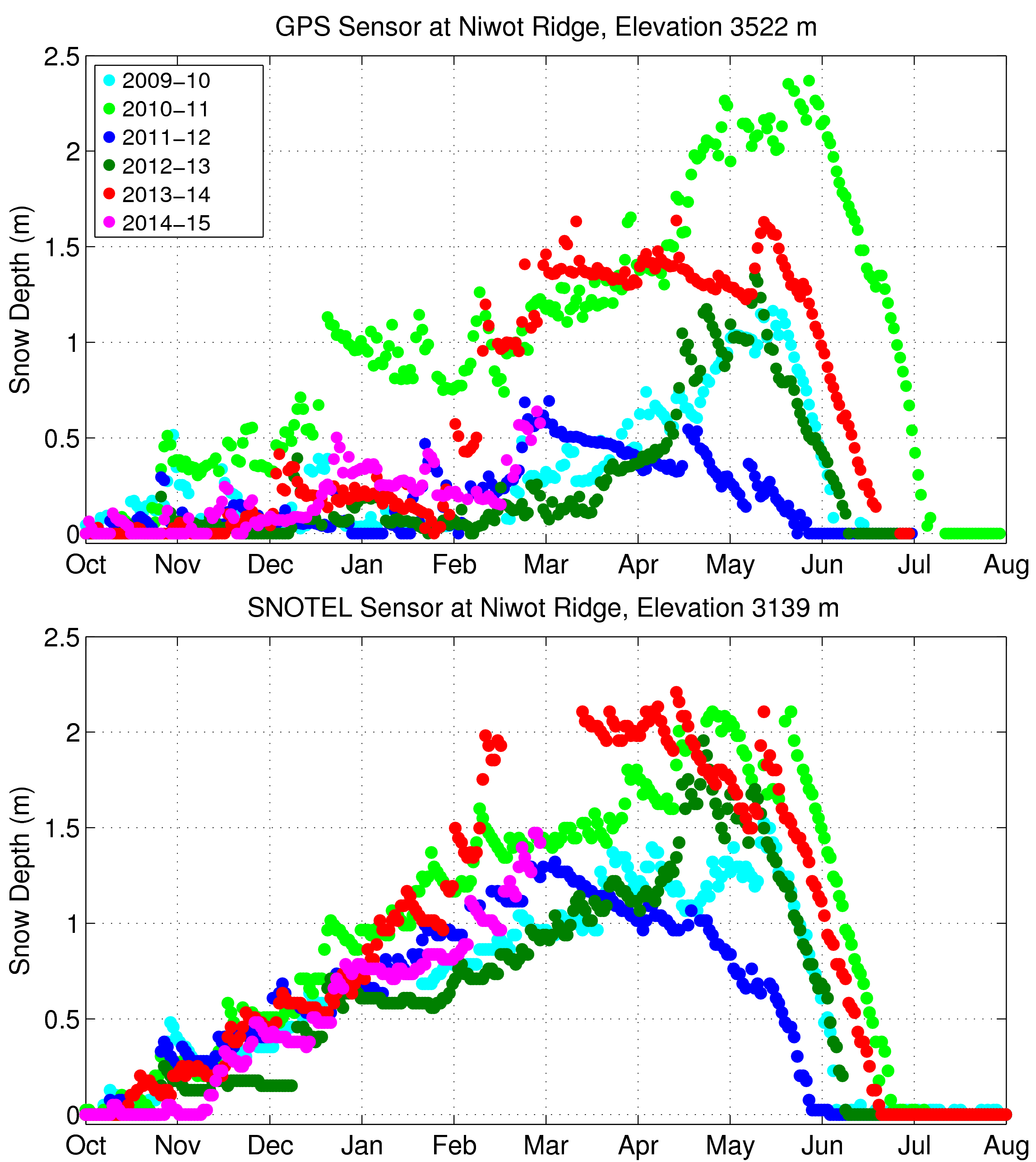
Figure 1. The GPS data are telemetered to UNAVCO every day at midnight. PBO H2O posts new snow depth estimates every morning and updates this plot every week. The SNOTEL sensor is at a lower altitude than the GPS sensor and surrounded by trees. The error bars have been removed to make it easier to see the results.


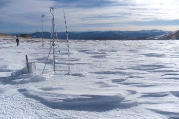
Figure 3. Niwot Ridge in the winter: the GPS antenna is in the foreground, along with a snow stake for manual snow depth measurements; the laser is in the background. (Credit: Ethan Gutmann)


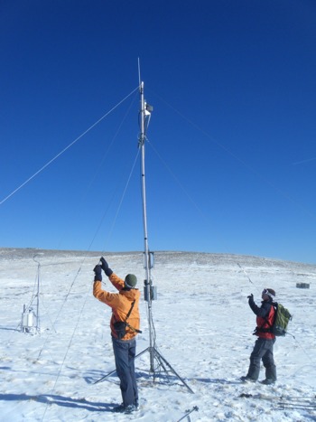
Figure 2. To verify the GPS snow depth measurements, we have also installed a scanner laser system, which is receiving periodic maintenance here. The GPS antenna is in the background. (Credit: Jordy Hendrikx)


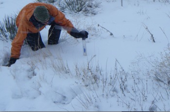
Figure 4. Without automated instruments such as the GPS, snow measurement involves painstaking work with a ruler or snow stake. (Credit: Jordy Hendrikx.)

Spotlight Questions

  • How much snow was there on April 1st in 2010, 2011, and 2012? Why would snow depth change so much from one year to the next?
  • Why would two nearby sites, the GPS site above treeline and the SNOTEL site below treeline have such different amounts of snow in different years?

Last modified: 2019-12-26  16:24:53  America/Denver  


Please send comments and corrections to educationunavco.org.

Copyright © 2012 - 2025 UNAVCO and the GPS Reflections Research Group.
All Rights Reserved.

Funding and Acknowledgements.