Science Spotlight

Station KULU


Researcher: Tonie van Dam
University of Luxembourg

I liked math, physics, and the outdoors. A career in geology and geophysics seemed to be a good way to combine those interests.


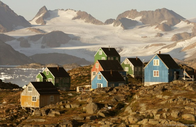
Kulusuk is located in eastern Greenland.


Name: Kulusuk
State: Greenland
Country: Greenland
Elevation: 67.4 m
Lat/Long:  65.5793 / -37.1494

Learning about Ice Sheets near Kulusuk, Greenland

The data from GPS KULU help us understand how the Earth's surface moves in southeastern Greenland. The Earth's surface should be uplifting in this region for two reasons. First, the Greenland ice sheet is melting. When you remove a load from the Earth's surface, the surface uplifts. But the Earth's surface in this region is also uplifting due to the fact that the area was covered with very thick ice about 10,000 years ago (the Pleistocene). Although most of that ice has melted, the Earth is still rebounding. This response is called post-glacial rebound.

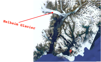
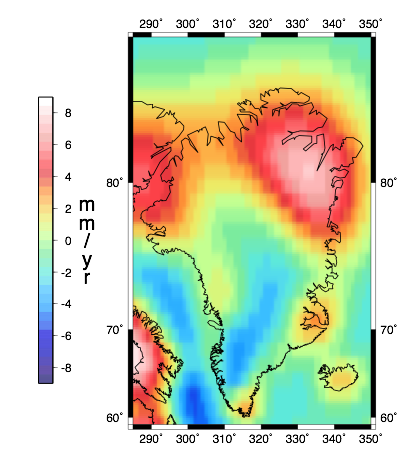
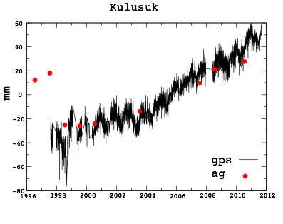
To separate the uplift from present-day melting from the response of the Earth to the Pleistocene melting (Figure 2), we need to combine the uplift/subsidence measured by GPS with absolute gravity observations (Figure 3). The GPS site at KULU was installed in 1996. Since then, we have taken nine absolute-gravity observations at the spot (Figure 4). We have been able to separate the motion from present day melting from the response of the Earth to the Pleistocene melting. However, what we have found is different than what we originally expected to see. Instead of just postglacial rebound and ice shelt melting (which would produce an effect that is linear in time), we can see the effects of the retreat of the Helheim Glacier (Figure 5), a rapidly-moving glacier about 100 km away from KULU. The timing of the retreat has been confirmed with other data.

Figure 1. The town of Kulusuk. Credit: Wikipedia Commons.


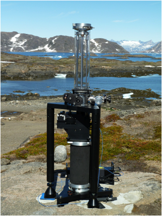
Figure 3. Absolute gravimeter at the KULU site. The instrument and all field accessories have a mass of 500 kg. The instrument is so sensitive we need to take the measurements in a tent.


Figure 5. Helheim Glacier with respect to the Kulusuk GPS station (the red balloon marked A).


Figure 2. Estimates of the rates of uplift of the Earth's surface around Greenland. These rates are based on a given ice-model from the Plesitocene and a given Earth model. (Image provided by A. Gerou and J. Wahr)


Figure 4. Uplift measured by the KULU GPS receiver is shown in black (in mm). The absolute gravity observations have been converted to equivalent uplift. Note now well the gravity tracks the GPS measurements. Also note the two earliest absolute gravity measurements. These are offset from the other g data because a hotel was built at the site in 1995!

Spotlight Questions

  • Figure 4 shows both GPS and g results, but GPS height is measured in mm and g is measured in m/s2. Can you think of a way to convert g data into mm?
  • Why would building a hotel contaminate measurements of g?

Last modified: 2019-12-26  16:24:55  America/Denver  


Please send comments and corrections to educationunavco.org.

Copyright © 2012 - 2024 UNAVCO and the GPS Reflections Research Group.
All Rights Reserved.

Funding and Acknowledgements.