Science Spotlight

Station KKN4


Researcher: John Galetzka
UNAVCO


Name: Kakani
Country: Nepal
Elevation: 1896.0 m
Lat/Long:  27.8007 / 85.2788

Gorkha Earthquake Dynamics

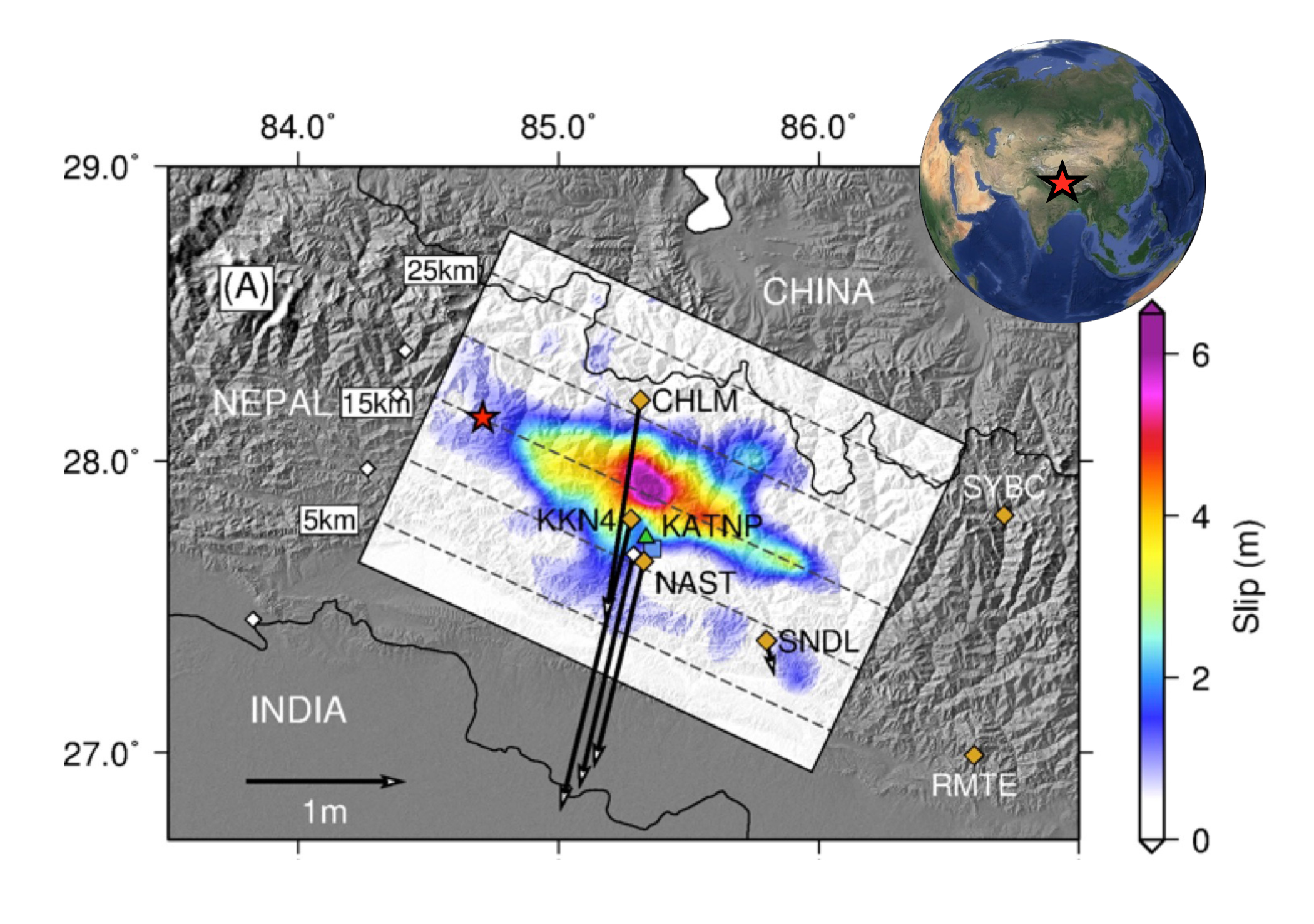
High-rate GPS data combined with accelerometer and satellite radar data show that the 25 April 2015 magnitude 7.8 Gorkha Nepal earthquake ruptured a 20-kilometer wide segment of the fault at depth. The rupture propagated toward the Kathmandu basin and the smooth slip onset caused only moderate ground shaking in the city. Greater damage, especially to taller structures in Kathmandu, was caused by whole basin resonance of the seismic waves.

Figure 1. Slip inversion results. The red star is the hypocenter location. Dashed contours are depths to the fault. Orange diamonds are the locations of the 5-Hz continuous GPS stations. (White diamonds are are low-rate stations). Black arrows show the coseismic offsets for sites with more than 10 cm of displacement.


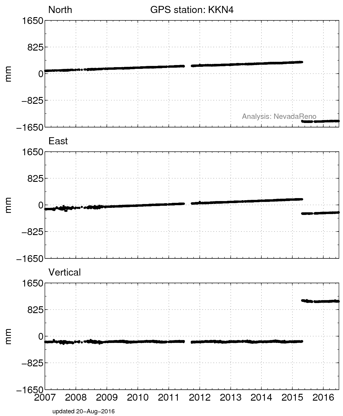
Figure 3. Position changes for KKN4 in the ITRF08 reference frame. (For help interpreting the graphs, see the GPS Data page.)


Figure 2. Displacements measured at two GPS sites during the earthquake: KKN4 and NAST.


Last modified: 2019-12-26  16:24:55  America/Denver  


Please send comments and corrections to educationunavco.org.

Copyright © 2012 - 2024 UNAVCO and the GPS Reflections Research Group.
All Rights Reserved.

Funding and Acknowledgements.