Science Spotlight

Station WUHN


Researcher: Wang Qi
China University of Geosciences


A staff member from the Institute of Seismology, China Earthquake Administration is checking a battery for the GPS site near Leigu, Beichuan County, Sichuan, China.


Name: Beichuan
Country: China
Elevation: 1002.0 m
Lat/Long: 31.802 / 104.444

Wenchuan Earthquake

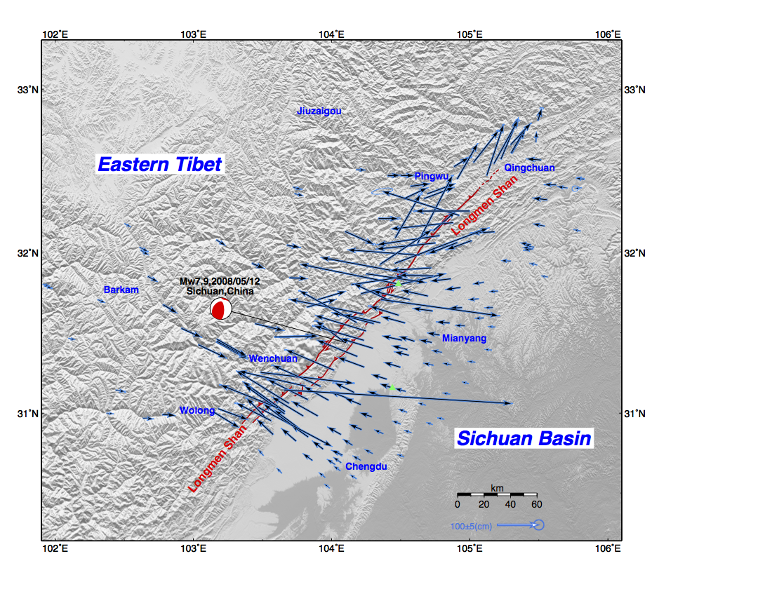
A large (Mw7.9) earthquake struck the Longmen Shan Fault in Sichuan, China on May 12, 2008. The official death and missing toll was more than 80,000. The earthquake broke the surface for more than 270 km along two reverse faults between eastern Tibet and the Sichuan Basin (Figure. 1). A joint team from Institute of Seismology, China Administration and China University of Geosciences, Wuhan (Figure 2) observed several hundred GPS sites in the two months after the earthquake to determine the coseismic or "static" displacements. Over 200 GPS measurements of the "static offset" caused by this large earthquake are shown in Figure 1. The maximum coseismic displacement observed by GPS in the hanging wall was 5.7 meters in horizontal and 3.9 meters in vertical.

Figure 1. Horizontal displacements observed by GPS associated with the 2008 Sichuan, China earthquake. The red solid lines denote the surface rupture. The green triangles indicate the location where the two GPS station photos were taken.


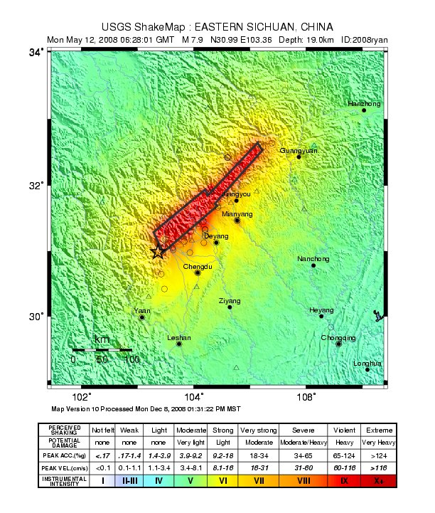
Figure 3. The USGS has calculated a shake map for this earthquake.


Figure 5. The Wenchuan earthquake caused broad destruction. Photo credit: REUTERS/Stringer CHINA.


Figure 2. The geodetic field crew.


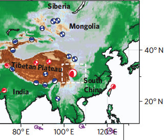
Figure 4. The tectonic setting for the Wenchuan earthquake. The red and white "beachball" in the square dashed outline is the location of the earthquake epicenter. Smaller earthquakes are also shown.


Last modified: 2019-12-26  16:24:49  America/Denver  


Please send comments and corrections to educationunavco.org.

Copyright © 2012 - 2024 UNAVCO and the GPS Reflections Research Group.
All Rights Reserved.

Funding and Acknowledgements.