Science Spotlight

Station P494


Researcher: Yehuda Bock


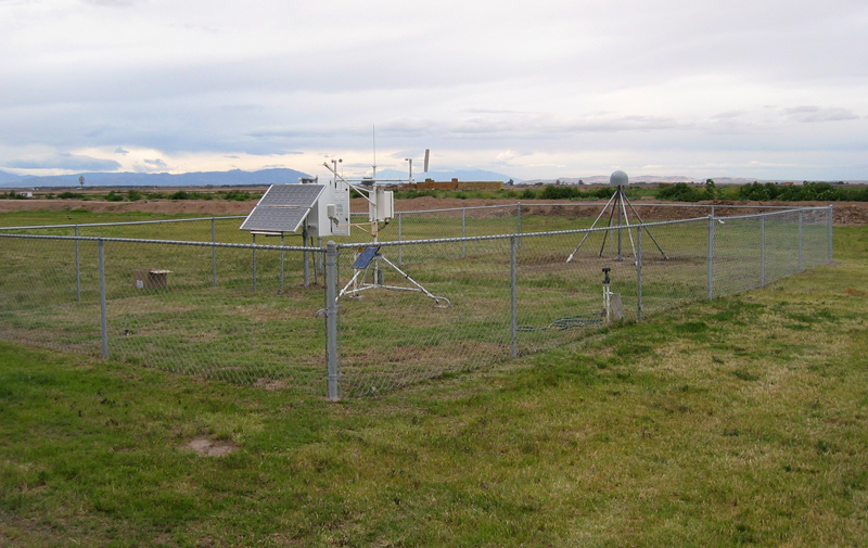
GPS station P494 is located near an seismic instrument called an accelerometer, used for measuring ground motions during earthquakes.


Name: WESTSIDEES
State: CA
Country: United States
Elevation: -44.3 m
Lat/Long:  32.7597 / -115.7321

Combining GPS and Seismometers for Earthquake Early Response

When we drive in a car, we become familiar with the concepts of speed and acceleration. The dashboard displays the speed of the car, which is the magnitude of the car's velocity. When the car accelerates, that means the speed of the car is increasing; decelerating is when the car's speed is slowing down. Velocity and acceleration are also key pieces of information for Earth scientists. In particular, they want to know the velocity and acceleration of the ground during an earthquake. This teaches them both about the earthquake itself and how seismic waves propagate along the rupture. Measuring ground acceleration and velocity is also important for determining how to construct safe buildings. However, while traditional seismic instruments are pretty good at measuring acceleration and velocity, they are not good at measuring the position of the ground during an earthquake. For this information, scientists need to use GPS.

The GPS data from P494 are being used by the SOPAC research group in an earthquake early warning project. They are combining the acceleration data from a seismic instrument with the GPS data. This combined datastream will allow them to make warnings for the Western U.S. Their system takes advantage of the strengths of both systems - the seismometer is more precise, but unable to provide position; GPS is less precise, but optimized for positions. The combined data are used to determine:

  • When (and where) an earthquake has occurred.
  • How large the earthquake is.
  • When the seismic waves generated by the earthquake will arrive at nearby large cities.

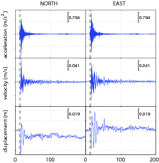
Figure 1. Typical time series of displacement, velocity and acceleration resulting from a combination of GPS and accelerometer data. The ground shaking can be clearly seen in the accelerations and velocities. These are temporary and go away after the earthquake. Note the permanent offset in the displacement time series, also called coseismic deformation, resulting from a magnitude 5.5 earthquake in southern California.


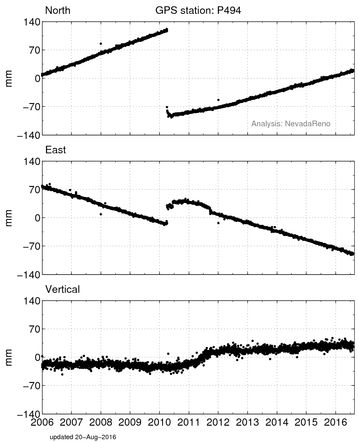
Figure 3. Positions of P494 in a North America fixed reference frame.


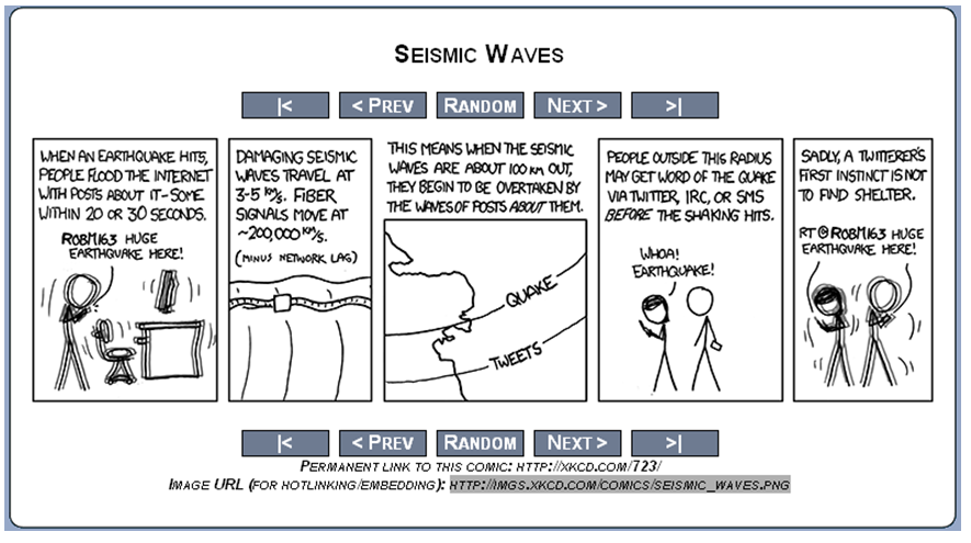
Figure 2. Cartoon showing the basic principle of earthquake early warning. Using the combination of GPS and accelerometer data we can detect when the first seismic (P) waves reach our monitoring stations and then calculate when the destructive seismic (S) waves will arrive. Often the warning time can be up to 2 minutes depending on the location of the earthquake and the sensor.

Spotlight Questions

  • What would you do if you had two minutes of warning that a large earthquake was about to happen?
  • What do you think caused the offsets in the time series in 2010 and 2011?

Last modified: 2019-12-26  16:24:51  America/Denver  


Please send comments and corrections to educationunavco.org.

Copyright © 2012 - 2024 UNAVCO and the GPS Reflections Research Group.
All Rights Reserved.

Funding and Acknowledgements.