Science Spotlight

Station LAUD


Researcher: Dan Smale
National institute of Water and Atmosphere

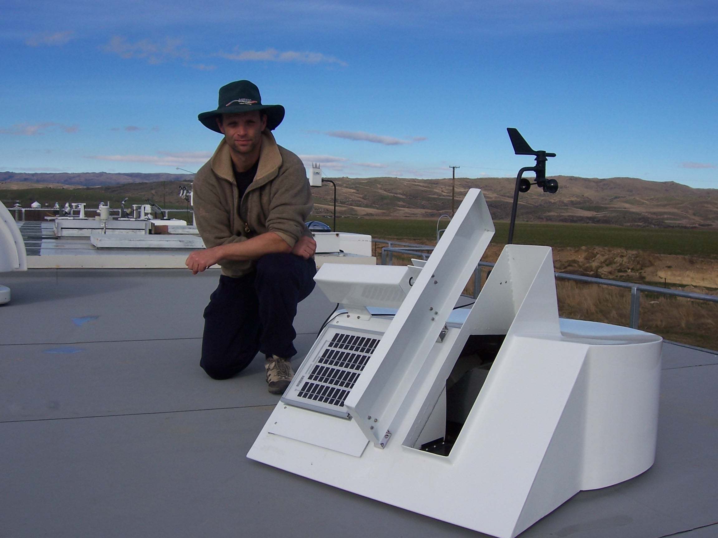
Dan Smale on top of the NIWA's Lauder atmospheric research laboratory optics building kneeling behind a solar tracker that feeds light into a Fourier transform spectrometer used to measure atmospheric trace gases (such as Ozone), greenhouse gases (such as Methane and Carbon dioxide) and water vapour.


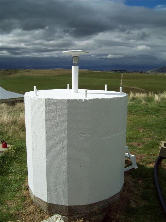
The antenna for the Lauder GNSS-PW system has been installed on an obsolete satellite ground station tracking monument. Built in the 1970s, the monument provided a rigid mount for a 6 metre radio telescope to track and download data from the ISIS satellites for studies on the ionosphere.


Name: Lauder
Country: New Zealand
Elevation: 372.5 m
Lat/Long:  -45.0149 / 169.7358

Measuring atmospheric water vapour for climate studies

GPS systems can be used to measure water vapour in the atmosphere as the amount is directly proportional to the time delay of the GPS signal. To facilitate such measurements, a GPS receiver was installed during May 2012 at the National institute of Water and Atmosphere (NIWA) atmospheric research laboratory located at Lauder, New Zealand. The purpose of the GPS system is to make continuous high precision measurements of atmospheric water vapour as part of the global GCOS (Global Climate Observing System) Reference Upper Air Network (GRUAN) and to supplement other atmospheric water vapour measurements (frost point hygrometers, Microwave and infrared spectrometer) made as part of the Network for the detection of atmospheric composition change (NDACC) global network.

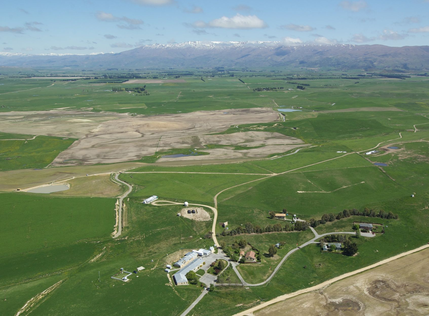
The Lauder research laboratory (Figure 1) celebrated its 50th Anniversary in 2011. The low rainfall, clear views of the horizon and its location away from the ocean and industrial areas make the Lauder site ideal for atmospheric studies. Such qualities have helped establish Lauder as one of the world's premier southern hemisphere atmospheric laboratories.

GPS precipitable water (PW) measurements are an integral part of the GRUAN network as they:

  • provide continuous high temporal resolution data (30-min, even at night time) to detect short-term PW variability (semi-diurnal & diurnal)
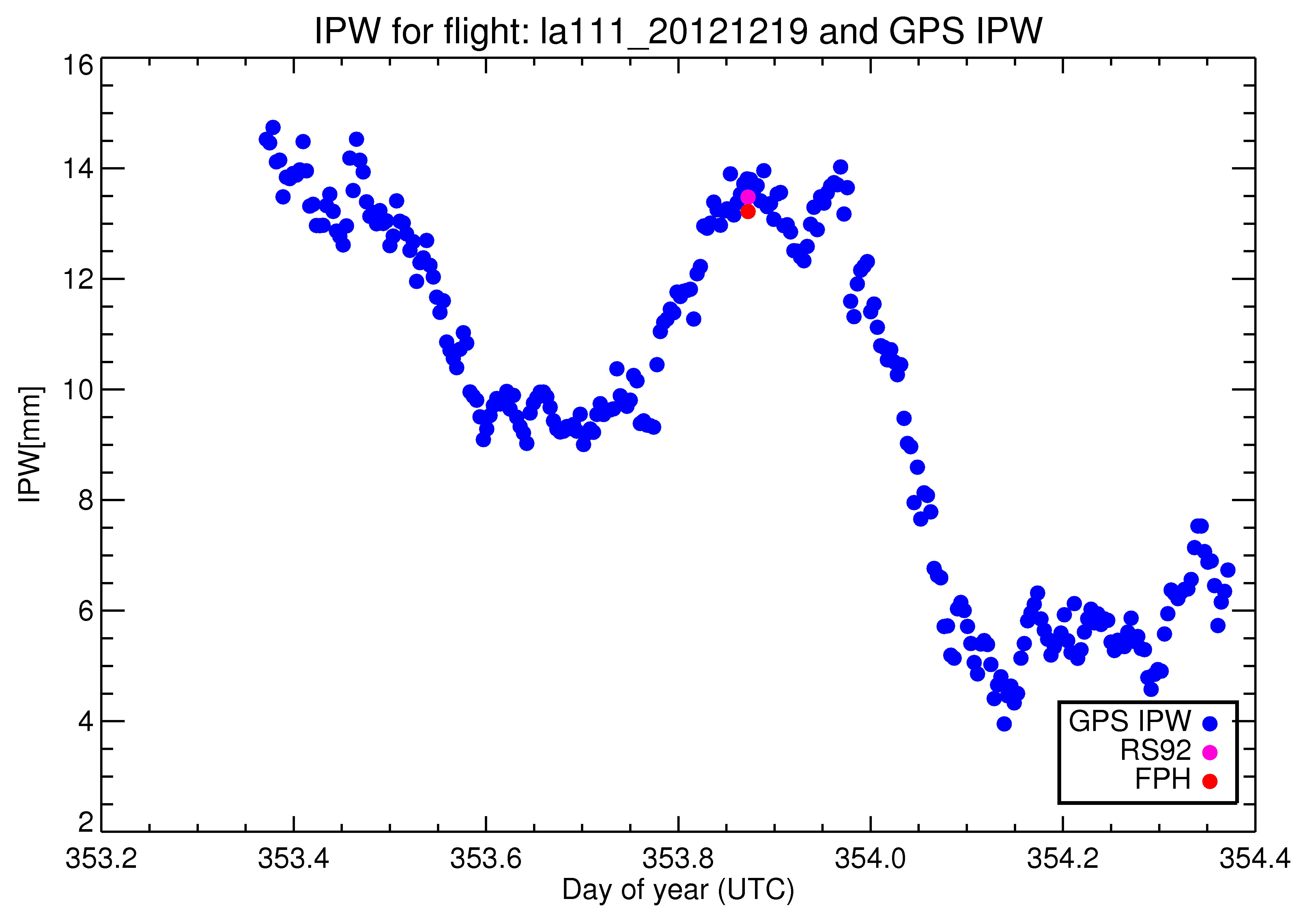
  • have high accuracy to allow us to validate other PW measurements (such as radiosonde and other remote sensing instrument, see Figures 2 and 4)
  • are very stable instruments (no data drift) needing little or no routine maintenance and calibrations. Such long-term instrument stability is critical for climate trend studies (GRUAN).
  • Can be operated very effectively as a global network as the instrument are standardised across the world. This allows measurements made at different sites to be directly compared with little inter-calibration required.

Figure 1. An aerial view of NIWA's atmospheric research laboratory located at Lauder, New Zealand. The laboratory is located in the middle of the north-south orientated Manuherika valley. The Dunstan mountain range (located to the south west of Lauder) is seen in the background.


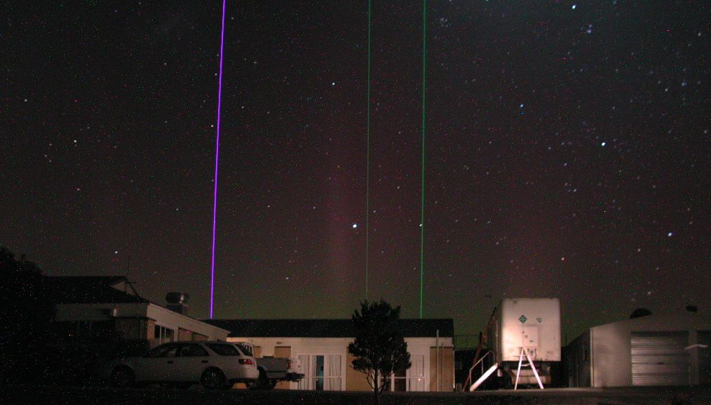
Figure 3. Three Lidars in operation at Lauder measuring Ozone and Water vapour. NASA deploys a mobile Lidar system in a truck-trailer to different sites around the world. In this campaign, the NASA Lidar is used to validate the Lidar measurements made at Lauder.


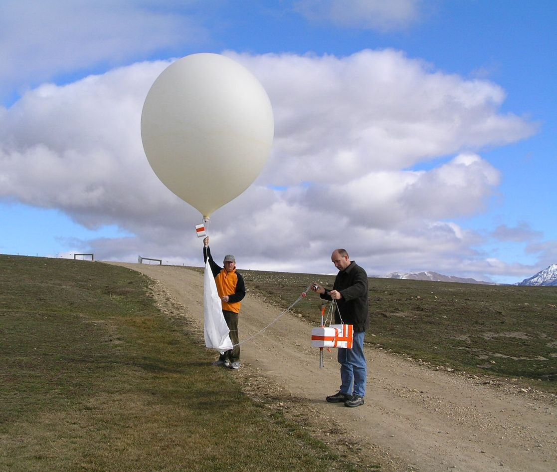
Figure 2. Technicians Alan Thomas (left) and Mike Kotkamp prepare to launch a Frost point hygrometer sonde (white package held by Mike). Atmospheric profiles (measurements at different altitudes) of water vapour, ozone, temperature and pressure are measured and sent via radio signals back to the ground base in real time. The Helium filled balloon will carry the sonde to altitudes of up to 30 kilometres (~18.5miles) above the earth.


Figure 4. Comparison of water vapour measurements (IPW) made with the Lauder GPS system and a frost point hygrometer sounding launched on 19th December 2012. There are two different sensors on the sonde that measure water vapour, both in good agreement with the GPS derived measurements. Credits: the FPH data were provided by Dale Hurst (NOAA-USA) and processing of the GPS data is courtesy of Yoshinori Shoji (MRI-Japan).


Last modified: 2019-12-26  16:24:55  America/Denver  


Please send comments and corrections to educationunavco.org.

Copyright © 2012 - 2024 UNAVCO and the GPS Reflections Research Group.
All Rights Reserved.

Funding and Acknowledgements.