Science Spotlight

Station CONZ


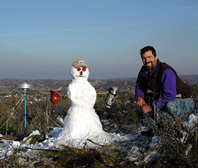
Researcher: Ben Brooks
U.S. Geological Survey

My job is never boring and never the same any day.


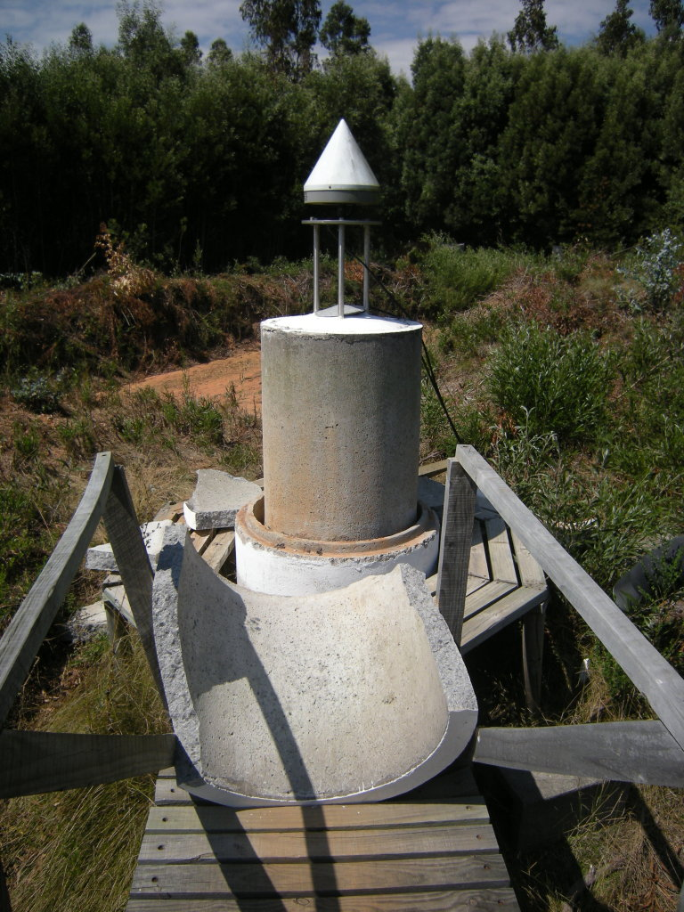
The monument supporting the CONZ GPS antenna was rebuilt after the earthquake.


Name: Concepcion
Country: Chile
Elevation: 181.2 m
Lat/Long:  -36.8438 / -73.0255

2010 Maule Earthquake

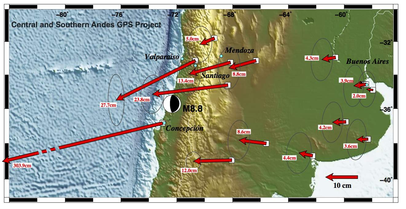
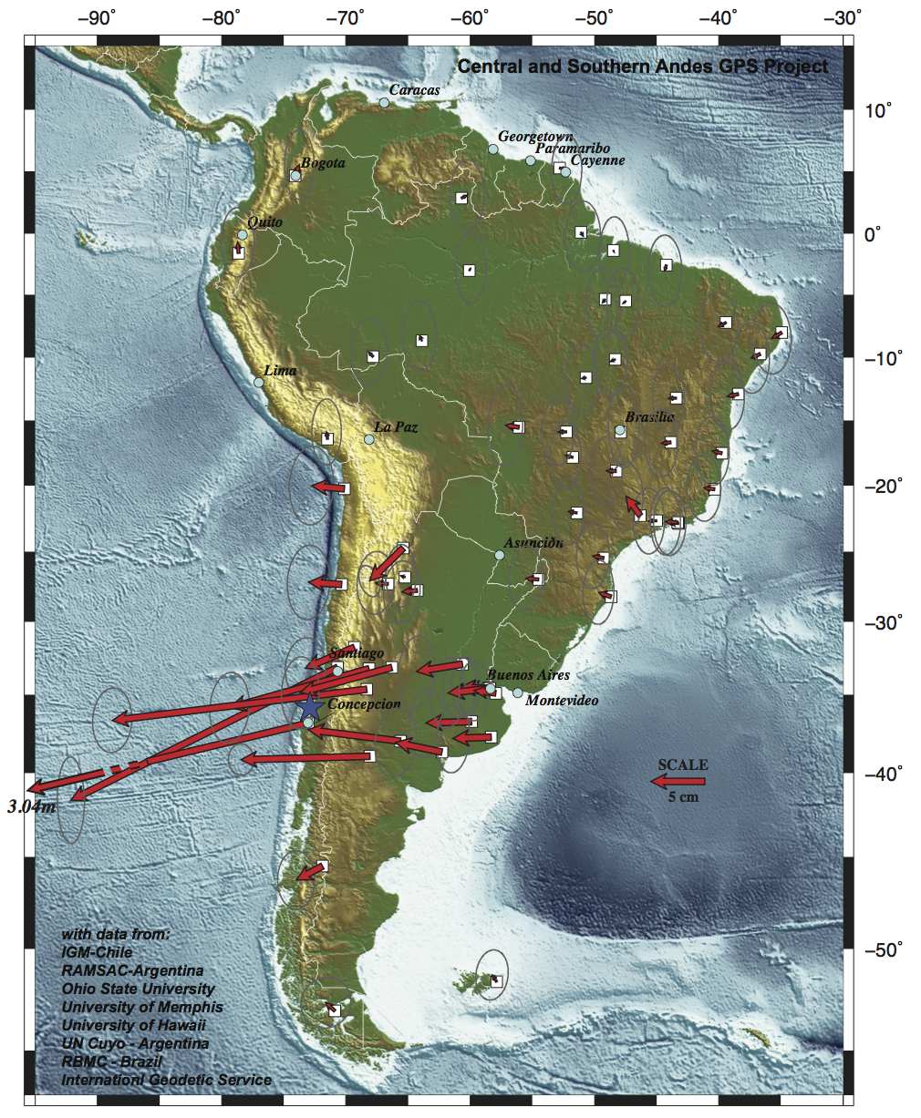
I have been part of a long-running GPS project in the Andes initiated by Mike Bevis (Ohio State University) and Bob Smalley (University of Memphis) called Project CAP (Central and Southern Andes GPS Project). Most of my own work has focused on the backarc region of active deformation in Argentina and Bolivia (Figure 1). Within hours of the Maule earthquake, the CAP team, with in-country collaborators in Chile and Argentina, started responding to the event. Bevis was already in Peru and he quickly made his way to Chile to oversee rapid response there. Smalley left for Argentina. James Foster and I, in Hawaii, started gathering and processing all of the GPS data. We produced the first publicly available displacement field (Figures 2 and 3) of the event showing the very large (up to a few meters) westward motion of many of the Chilean stations. Additionally, we were amazed to see that stations on the far eastern margin of the South American continent, in Buenos Aires, for instance, also had measurable westward displacements (2-3 cm) from the earthquake. SInce those early days, I have led the operation of the GPS network in the backarc and continue to process the data showing post-seismic deformation.

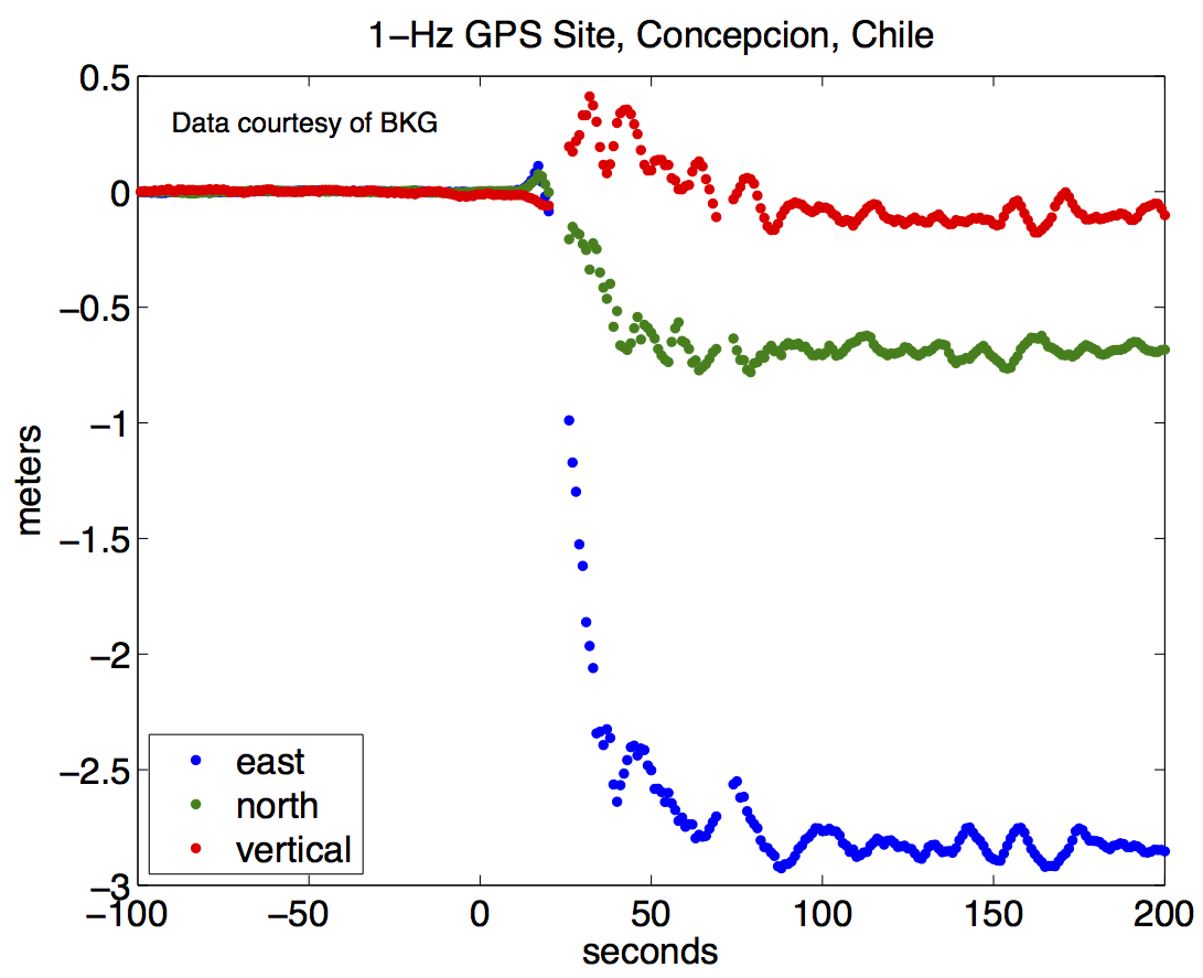
In addition to the displacement maps, GPS can also be used to measure how the ground moves during the earthquake (Figures 4 and 5). This relatively new application for GPS is called GPS seismology.

The CONZ GPS site is supported by the University of Concepcion and BKG as part of their TIGO installation. Watch a YouTube video about TIGO in Spanish

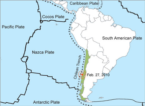
Figure 1. Tectonic setting of Chile. Map credit.


Figure 3. A zoomed in view of the displacements caused by the Maule Earthquake.


Figure 5. This photo shows how dramatically the GPS monument was moved during the earthquake.


Figure 2. Displacements measured by GPS that were caused by the Maule Earthquake.


Figure 4. GPS can also be used to measure how the ground moves during the earthquake. In other words, GPS can be a seismometer. Each colored dot in the figure shows the position of the CONZ GPS receiver for one second. Credit: K. Larson.

Spotlight Questions

  • From the GPS results in Figure 4, can you figure out how much the ground moved during the earthquake and in which directions? Does it agree with the map in Figure 2?
  • Concepcion lies between which two tectonic plates?

Last modified: 2019-12-26  16:24:57  America/Denver  


Please send comments and corrections to educationunavco.org.

Copyright © 2012 - 2024 UNAVCO and the GPS Reflections Research Group.
All Rights Reserved.

Funding and Acknowledgements.