Science Spotlight

Station CAYA


Researcher: Vladimir Kostoglodv
Istituto de Geofisica, UNAM


CAYA is located in the small village of Cayaco.


Name: Cayaco
State: Mexico
Country: Mexico
Elevation: 25.9 m
Lat/Long:  17.0485 / -100.2672

Guerrero Slow Slip

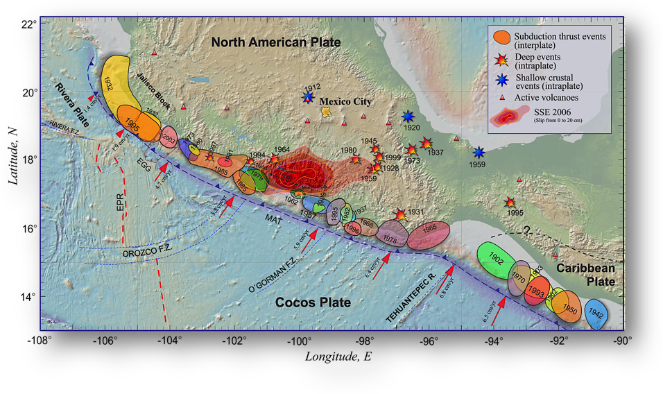
On September 19, 1985, a Mw (moment magnitude) 8.0 subduction zone earthquake ruptured a 140 km segment of the plate interface on the Pacific coast of Mexico in the state of Michoacan. Even though the epicenter was more than 400 km from Mexico City, it was heavily damaged by the quake.

Where will the next great earthquake be along the plate boundary? Geophysicists use a theory called "seismic gap" to help them understand where the next great earthquake is most likely. This analysis showed that the most dangerous area is the Guerrero Seismic Gap, G-GAP (Singh et al., 1981). This gap extends for ~100 km northwest from the city of Acapulco. There have been no earthquakes larger than Mw 6 in this region since 1911. Statistically the recurrence period for large shallow subduction earthquakes on the Mexican coast is of order of 30-60 years. This means that the G-GAP is "overdue."

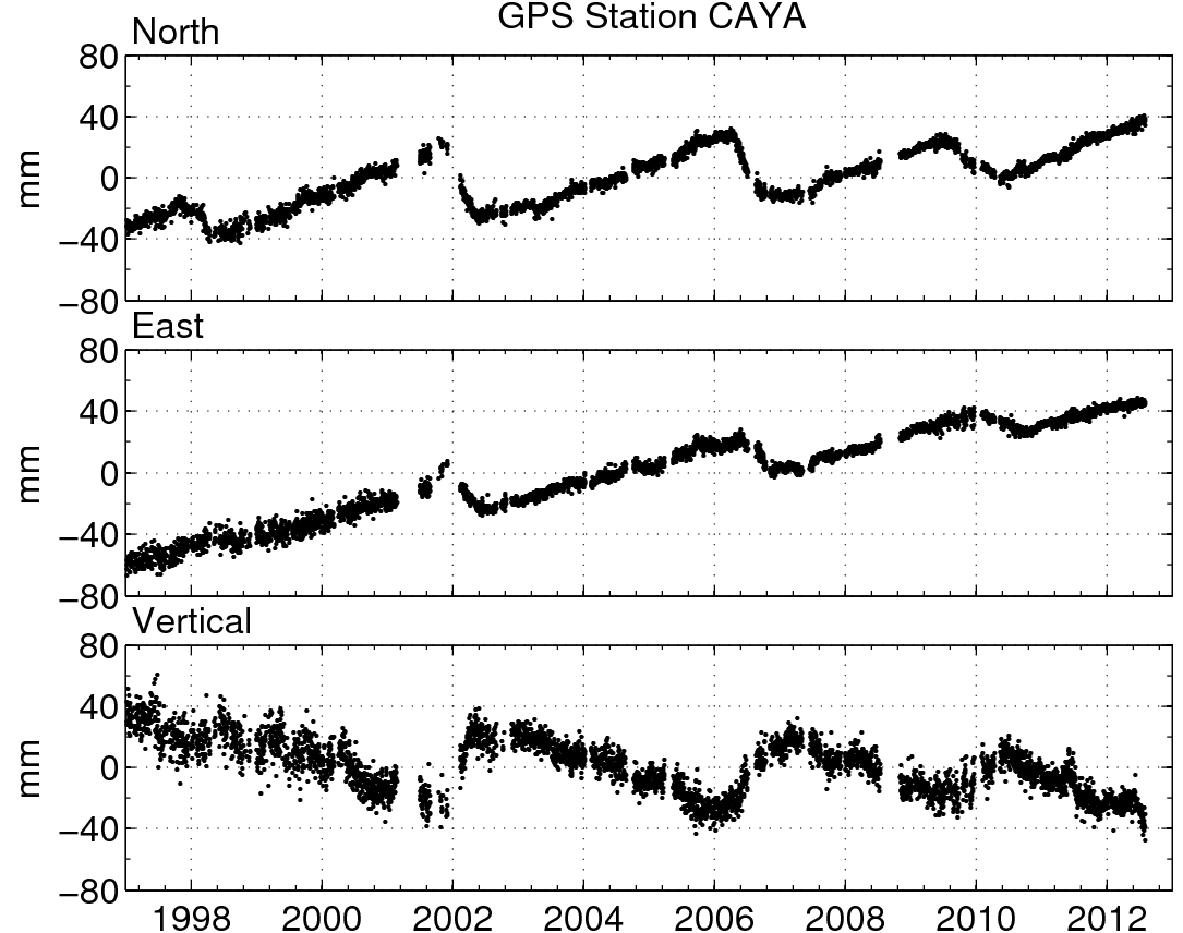
To study the behavior of the G-GAP region, we started a GPS network in southern Mexico. The first permanent GPS station (CAYA) was installed in 1997 in a small village called Cayaco, located in the middle of the gap, about 60 km northwest from Acapulco. A few years later the site in Acapulco (ACAP, Figure 2) was installed. More than 15 years of continuous GPS record at CAYA reveals an amazing history of coastal deformation in the gap. The long-term deformation is produced by the interaction between the subducting Cocos and overriding North American plates (Figure 3). Every 3-4 years we see Slow Slip Events (SSE), each lasting 6-12 months (Figure 4). These aseismic episodes recover a significant part of elastic strain, which is accumulating during the interseismic period. The resulting long-term strain rate in the G-GAP is only 25-30% compared to regions bordering the gap. If the GPS estimated value of the long-term strain rate is persistent over the seismic cycle, the recurrence period for a great earthquake in the G-GAP could be more then 400 years.

Figure 1. Rupture areas of the most recent subduction thrust earthquakes in the Mexican Pacific coast (shaded ellipse-like patches), and the Guerrero seismic gap. Slip distribution of the 2006 SSE on the plate interface shown as large, gradually shaded red area, was estimated from a joint inversion of GPS and InSAR data (Cavalié et al., 2013).


Figure 3. Position changes for CAYA in a North American fixed reference frame.


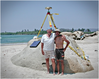
Figure 5. Dr. Kostoglodov and Jose Antonio Santiago have installed many GPS sites in southern Mexico.


Figure 2. The GPS station in Acapulco overlooks the beautiful harbor.


Figure 4. The 2006 Slip event, as measured by GPS (Larson et al., 2006). Normal plate motion is shown by the black vectors. The colored vectors show how the GPS station moved during the slip event.


Last modified: 2019-12-26  16:24:57  America/Denver  


Please send comments and corrections to educationunavco.org.

Copyright © 2012 - 2024 UNAVCO and the GPS Reflections Research Group.
All Rights Reserved.

Funding and Acknowledgements.